© Steven J. Cary, April 2023
Happy April all you New Mexico butterflyers. I hope it has been worth the wait after what seemed like a rather long, cool, dampish winter. I think Santa Fe experienced four or more consecutive months without breaking 50 degrees F. And then we had good moisture; mountains had great moisture. I know much of eastern New Mexico remains dry. Most of us, though, can look forward to the coming months with some optimism, and that puts a spring in my step, and in yours, too, I hope!
This month’s blog has three parts: two illustrated stories of my recent travels, plus an announcement for the 2023 Margarita Challenge, which I hope turns out as exciting as the title. I hope you enjoy all the pieces and I look forward to your feedback. Speaking of that, please note my new email address: sjcary1@outlook.com, in case you want to contact me personally. OK, off you go . . .
Early Spring in the Chiricahuas.
Early in March, Marcy and I made a week-long trip to the Chiricahua Mountains of southeast Arizona, where we had arranged to meet separately with two sets of long-time friends. This trip would be the maiden voyage for our new, slightly larger Alto trailer, which we were excited to try out. The full drive from Santa Fe is a bit much for us to do in a day (we drive slowly and don’t like to drive at night), so we set the attainable goal of making it to a dispersed camp spot on BLM land south of I-10 near the Gage exit, west of Deming.
The trip down was a bit windy, but the trailer handled well. We arrived at our sunny camp spot at about 3:30 pm. A brief walk into the desert toward a pile of rocks produced a rattlesnake (western diamondback, I believe, based on the raccoon-striped tail). Air temperatures seemed a bit marginal for rattlers, but basking among warm rocks allows for more activity. It saw us first (naturally); it fell noisily off a small rock ledge, began to rattle modestly and to taste the air with its forked tongue. Clearly, spring was arriving! Sorry, no photo.
The next day, Marcy and I arrived early at our “hipcamp” site in Sulphur Springs Valley on the west side of the Chiricahuas. The site was on flat ground a few miles east of Sunizona at about 4600 feet elevation. This is desert grassland and shrubland, not a scrub/succulent/cactus desert; daily temps during our stay varied from low 30s to high 60s; the wind blew. Several creeks in the area, including Turkey Creek, drain the west slope of the Chiricahuas. These watercourses are usually dry, but they can flow after summer thunderstorms and during snowmelt. During our visit, all the creeks in the area were flowing impressively well – hub-deep at road crossings. The west slope of the Chiricahuas still showed snow on north-facing slopes in the high country, but that would fade significantly during our three-day stay here. Given all the apparent moisture, life in the valley seemed likely to prosper once the weather warmed.
By 5:00 PM our group was complete, including Idahoans Swen and Debbie plus fellow Santa Feans Peggy and Hans. Of the six of us, five had attended graduate school at New Mexico Tech in Socorro in the 1980s. I was the oddball (U. of Wisconsin) but have become used to that over the past 25 years and consider myself to be part of the NM Tech Auxiliary. Among us, we shared a love of nature, outdoors, and the beginnings of various indignities that beset humans as they transition from 60 to 70 years on planet Earth. We settled in and caught up on lives and families; happy hour; dinners cooked separately, then eaten together. After sunset, we voted for games rather than a campfire; we were gratified to be able to accommodate all six of us at the dining table of our new trailer. Frosting on the cake was the full moon rising over the Chiricahuas. Life is good!
Over the next two days we did easy to moderately challenging hikes in the Chiricahua National Monument and in the Dragoon Mountains across the valley to the west, site of Cochise Stronghold, plus associated trails and campgrounds. In his commodious Ford F-150, Swen chauffeured all six of us around to trailheads leading to outstanding geological formations, beautiful and noisy watercourses, local wildlife and interesting landscapes.
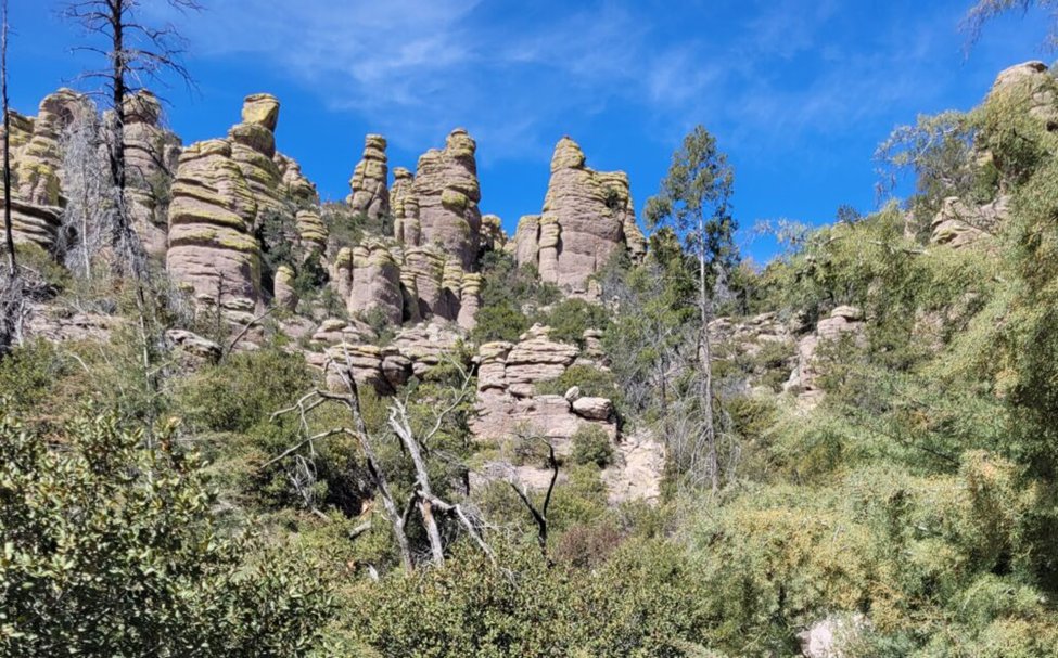
Rock spires and hoodoos in the high country of Chiricahua National Monument.
For Marcy and me, the Monument produced the biggest moments, shared with a herd (flock? pod?) of coatimundi, (Editorial note, the term for a group of Coatis is “Band”), which was casually foraging its way up the slopes behind us, then passing us. Coatis may be the cutest mammals ever invented. Foraging with nose to the ground and tail in the air, each scratches in leaf litter, turns over small rocks, examines tree bark, always looking for a tasty morsel. Long, brown, slender tails always point skyward; the dark tip nonchalantly flopped over, perhaps to help each keep an eye on the other’s whereabouts; their occasional subtle clicks and snorts also may play a part (for the ears, of course). There seemed to be about 20 of them, ranging from 1 to 2 feet tall. Needless to say, they functioned well as a group.
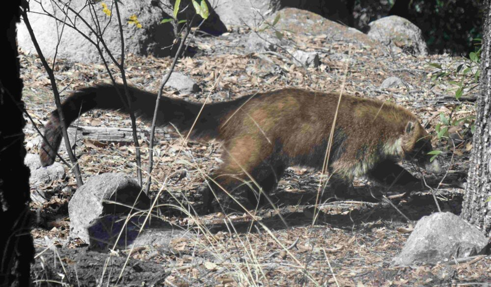
One of the band of coatis we saw at Chiricahua National Monument, Arizona.
Butterflies were few over these three days. The sun shone but it was not particularly warm; the wind blew and overall, I think it was simply too early in the season. Few wildflowers of any kind were seen, despite what seemed to be moist soil, normally a good indicator of coming plant life. A week of 80˚F temperatures would surely bring things to life, eventually.
We did see some of the expected hibernators, including Satyr Commas, which seemed overjoyed to be active again. Fresh Dogface Sulphurs, perhaps 5-6 per day, flew methodically northward; Sleepy Oranges flapped predictably among the shrubs; a few Dainty Sulphurs showed themselves, too, but not in large numbers. An occasional Pipevine Swallowtail also was spotted, usually at a distance.
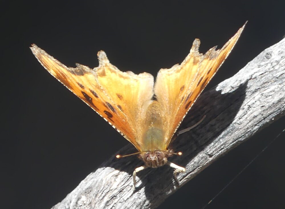
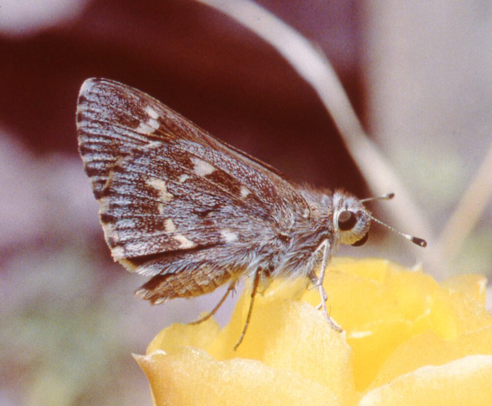
Moist soil along a nicely flowing Stronghold Creek attracted some Echo Azures. A beautifully fresh Pipevine Swallowtail dazzled us briefly at the mud, but was not interested in posing for more than a single photo.
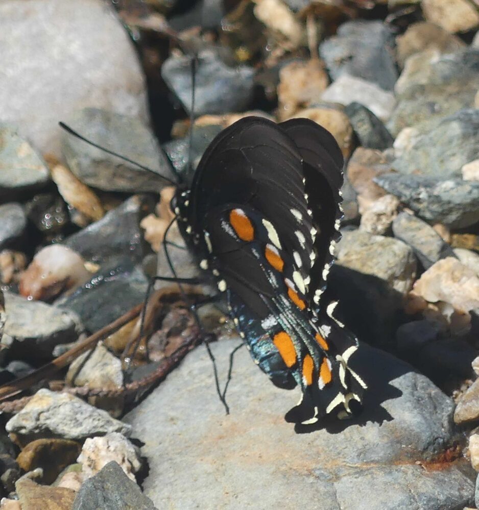
Pipevine Swallowtail (Battus philenor) Stronghold Creek, Dragoon Mountains, Cochise Co., AZ
After a final dinner and a long-burning, oak-fueled campfire, we retired for our last night at Peaks Valley Preserve. Morning arrived right on schedule and we said “adios” to our first crew of wonderful friends.
Marcy and I hitched up our trailer and set off to meet with our second group of friends: Karen and Tracy from Santa Fe, Holli from Tucson, and Susan and Craig from Albuquerque. They rented an AirBNB in Portal, on the east side of the Chiricahuas. There is a road directly over the top of the mountains, but it was closed, as it usually is in winter. Our alternative was perhaps a three-hour drive: north to Willcox, east to Road Forks, then south on NM 80, which got us to Rusty’s RV Park north of Rodeo, NM. We have stayed here before and have come to enjoy their laidback attitude, friendly prices, and comfortable accommodations. Plus, it placed us about 15 minutes from Portal, AZ, the northeast portal to the beautiful Cave Creek area of the Chiricahuas.
Our friends were making longer drives from the north and were still an unknown distance away, so we kept busy by tracking down their accommodations, checking on road conditions, and investigating the river flow situation. Before long, they made the turn into their quarters. Their late afternoon arrival allowed for an enjoyable happy hour and a tasty, filling meal together. We made our plans for hikes over the next two days, then Marcy and I went back to our camp.
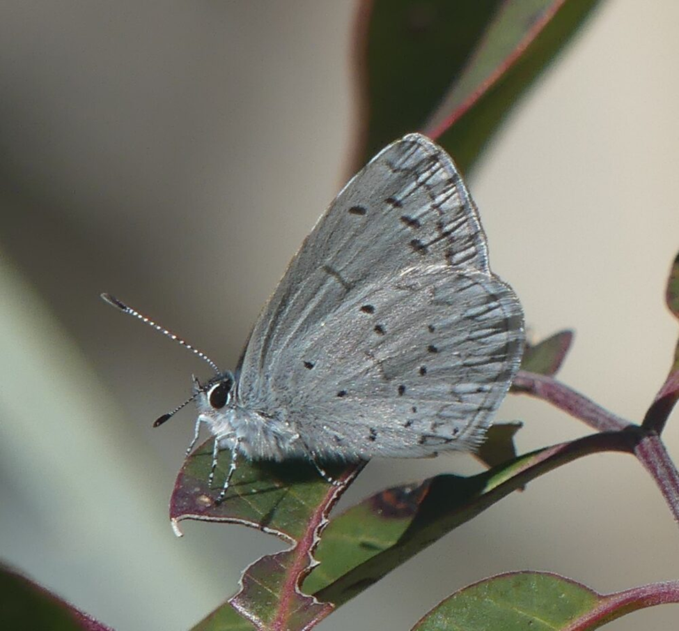
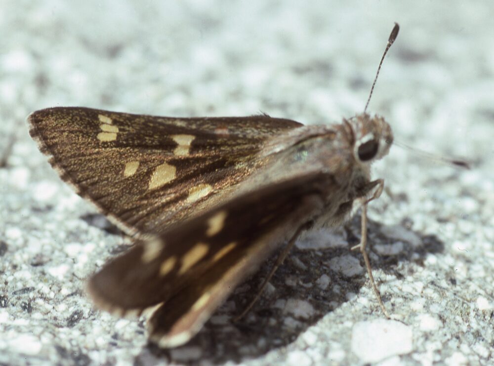
At the local Coronado National Forest Ranger Station just west of Portal, local volunteers staff an information table. They have maps, swag, lots of information and very friendly faces. There the next morning, the staffers confirmed what we feared: creeks were very high and our two preferred trails would be very short outings due to high water. Not easily deterred, though, we drove the short distance to our first choice, the South Fork Trail, which anchored a lovely hike along the South Fork of Cave Creek. The level trail meandered easily among the gallery woodland of alligator junipers, Arizona cypress, evergreen oaks, and smooth-barked sycamores – still to leaf out – alongside a noisy South Fork of Cave Creek. At mile 0.7, we reached our first creek crossing and learned that the volunteers had been right. Water was high. Other times Marcy and I had reached this spot, the creek bed had been either dry with a narrow trickle or easily rock-hoppable with a walking stick as support. No such luck this day – no dry rocks in sight. True, we could have removed our boots and taken our chances in two feet of water over a rocky, cobbly streambed, but knowing that we would have to do that five more times over the next two miles was deflating. So we turned around and walked back the way we had come, but more slowly so as to absorb more of the place, the bird chatter, the warming day, and the Echo Azures decorating damp creekbanks.
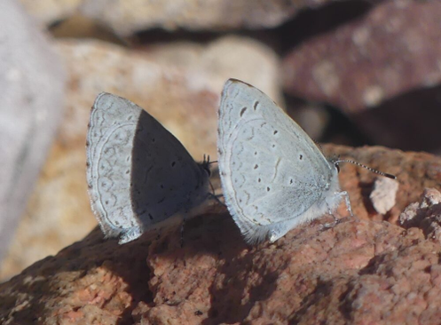
Echos Azures (Celastrina echo cinerea) South Fork Cave Creek, Chiricahua Mountains, Cochise Co., AZ
After additional head-scratching and map consultation, we settled on the hike from the ranger station up toward Silver Peak. Marcy and I have done that before and enjoyed it. We have yet to make it to the summit, but the route offers a good trail and tremendous views while walking among grasses, agaves, oaks and point-leaf manzanita. Plus, no river crossings. On this day the manzanita was in full bloom; it was the magnet plant to which the modest number and diversity of butterflies were attracted.
Echo Azures, White Checkered-skippers. Solitary Southern Dogface sulphurs (all very fresh) slowly worked their way north. The most prevalent butterfly of the day was Southwestern Orangetip (Anthocharis thoosa). Males may have been on the Silver Peak summit, but how would I know? Down on the lower slopes where we walked, a few females were flying with low energy right alongside the meandering trail. Perhaps it was the mild-to-cool temperatures or the occasional clouds that kept them close to home. Perhaps it was their patiently deliberate search for host mustards. In any case, they were surprisingly easy to photograph. Some basked near the ground; others nectared at the manzanita.
The next day dawned cool, but mostly sunny – perfect for a hike in the mountains. We selected the Snowshed Trail, which the volunteers recommended for our group. It walked us gradually up to a sunny lunch perch, then gradually down through mid-elevation juniper/oak savannas. We ogled in amazement the unique plant communities and riparian woodlands offered by this part of the world. The slow-to-heat north-facing slope and the not-quite-warm temperatures kept butterfly distractions to a minimum.
On the whole, we all came to realize and appreciate what a special place we were visiting. Some had their eyes opened as to the remarkable hiking/camping opportunities in this area. Marcy and I enjoyed getting out of Santa Fe’s ongoing gloomy winter (though good for skiers). I got to see and photograph my first butterflies of the year! Would we return? Indubitably, when the opportunity presents itself.
2023 Margarita Challenge
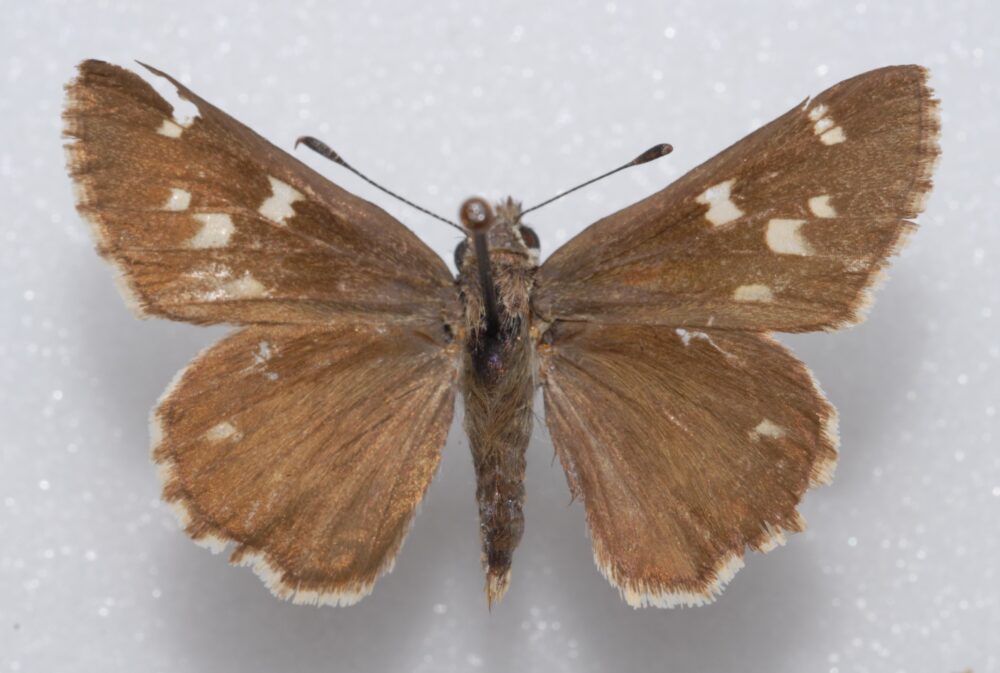
The 2023 Margarita Challenge. What is this, a drinking game? You wish! Even better, this is an opportunity to help us all get a better grip on the geographic distributions of Margarita Skipper (Atrytonopsis margarita) and Python Skipper (Atrytonopsis python) in New Mexico. These two skippers are very similar and were only distinguished from each other via genitalia in 2015. Both occur in New Mexico, but the specific range for each remains to be more precisely elucidated. Each species looks like this ventrally:
We have made some progress mapping each, but we still need more data from these areas:
- Chuska Mountains (San Jua County)
- Sacramento and Sierra Blanca mountains (Otero and Lincoln counties)
- Florida Mountains (Luna County)
- Hidalgo County
- Catron County
- Datil, Mangas, Tularosa and Gallo mountains (Socorro and Catron counties)
- Magdalena and San Mateos (Socorro County)
- Northern Black Range (Sierra, Socorro, Catron counties)
- western Zuni Mountains (McKinley County)
- Manzano Mountains (Torrance County)
We have little to no data from these areas. That could be due to few of us looking there in the past. It is also possible that these butterflies do not live there. We won’t know until we look. How can you help?
Specimens, if you can collect some, will give us the best resolution because we can run DNA, which will be the final arbiter in cases where the two arguably distinct phenotypes have a degree of intermediacy. If you collect specimens for this project, please contact me at sjcary1@outlook.com so we can arrange to get samples to Nick Grishin’s DNA lab.
Photographers can help by documenting uppersides. That sounds like a small request, but these butterflies do not make it easy. Both species prefer to perch and nectar with wings closed. Their undersides can be beautiful, so that’s not a bad thing, but the only known diagnostic marks are on dark gray-brown uppersides, where pale spots are white on Margarita but yellow-gold on Python (see below).
Obtaining good upperside views will require you to dig into your bag of photography tricks, but I know you like a challenge. First and foremost, keep in mind that these species are major nectar hounds that prefer purple flowers. They also fly during what is typically thistle season. With that in mind, consider searching early in the day when adults may still be warming up and showing some dorsal surfaces. In cloudy conditions, too, the need to thermoregulate may come along any time of day, so be ready for those rare, open-wing opportunities. Lastly, if your camera has a “burst mode” you can depress the shutter button and shoot continuously for as long as your battery lasts (bring a couple extra batteries). I get behind a perched or nectaring individual. Then, while clicking away, I startle the butterfly off its perch. With luck, I capture the first wing flap and some of the upperside. You may have other tricks up your sleeves, too. Please share any of your images to iNaturalist or to me personally here: sjcary1@outlook.com
If you choose to accept this challenge, please consider the following:
- Best dates to look are May 15 to June 15, but things seem a little behind this year.
- Best elevations 6000 – 8000’
- Adults love nectar from pink/purple flowers, especially thistles, but also legumes and even cactus flowers.
Once you have shared your images or specimens, then yes, feel free to responsibly enjoy a margarita!
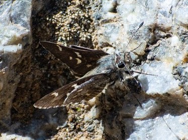
MARGARITA CHALLENGE UPDATE: MAY 11, 2023: Joe Schelling took the photo below today in the Sandia Mountains east of Albuquerque. Margarita is on the wing! and Joe’s photo shows the upper wing surface, proving that it can be done. Thanks Joe! Jim Brock in Tucson also advises that Python is flying in the Santa Catalinas as of May 8. As Joe said, “let the games begin.”
Pygmy Forest Butterflies
The Chiricahuas gave me a sense of how things were eventuating down south in mid-March, but how about in northern New Mexico in mid-April? Determined to find out, I spent one afternoon hour at Heron Lake State Park, specifically in their “Pygmy Forest” of stunted trees in the arc of land between SR 95 and the Rio Chama Gorge below Heron Dam. This is a topographically high area (~7200 ft elevation) with little soil atop the creviced and fractured bedrock. Plants take root in the cracks, but find little water, and so grow very slowly. Probably any large pines were harvested from this area 100 years ago. The resulting landscape is far from lush, but there are interesting plants as well as high spots and low spots, with good patches of sun and shade. No one ever goes there so it also provides peace, quiet and solitude.
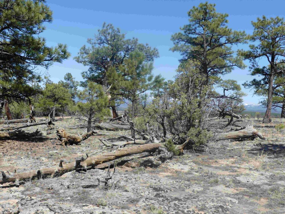
The “Pygmy Forest” at Heron Lake State Park
On Sunday April 16, I arrived at 2:30 and walked the area for an hour. Temps were low to mid-60s, with bright sun and a breeze. First to come to my attention were Painted Ladies. I kept on walking toward the gently rounded high spot on the rim, trying to stay simultaneously in the sun yet screened from the wind by stands of juniper and pinon pine. Neither wildflowers nor butterflies were abundant, but soon enough a Painted Lady zoomed past me headed generally north.
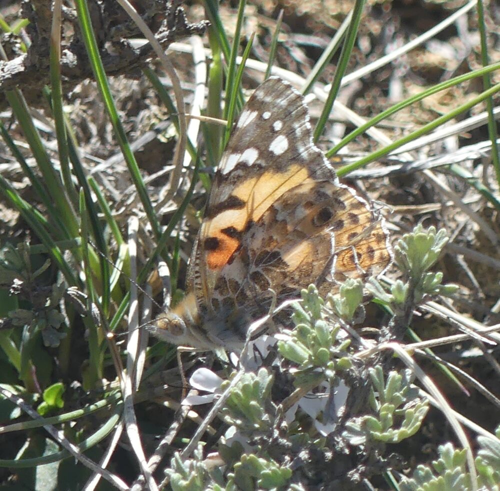
Northbound Painted Lady (Vanessa cardui)
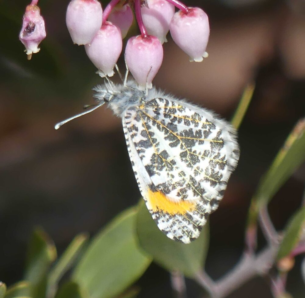
I walked on with eyes scanning for winged creatures. Next came a white, which paused briefly to nectar, long enough for me to get some quick photos before it moved on. I looked to my images and zoomed in on one to where I could see it had been a Desert Marble. That was one of the three whites I was hoping to see. And then came a Red Admiral, my first of the year.
Moseying slowly along I neared the barely detectable high spot along the gorge rim. By then I had seen several Spring Whites, all looking to nectar at a 4-inch tall, white-flowered mustard, probably an Arabis species, which occurred in scattered patches throughout the mixed vegetation. All were fiercely blooming away at ankle height, like small drifts of snow. And speaking of snow, it seemed that several sheltered patches of very damp soil had been under snow just a few days earlier. This was early spring, for sure.
Desert Marble (Euchloe lotta)
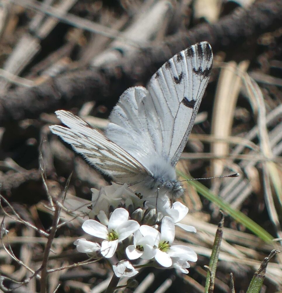
Spring White (Pontia sisymbrii)
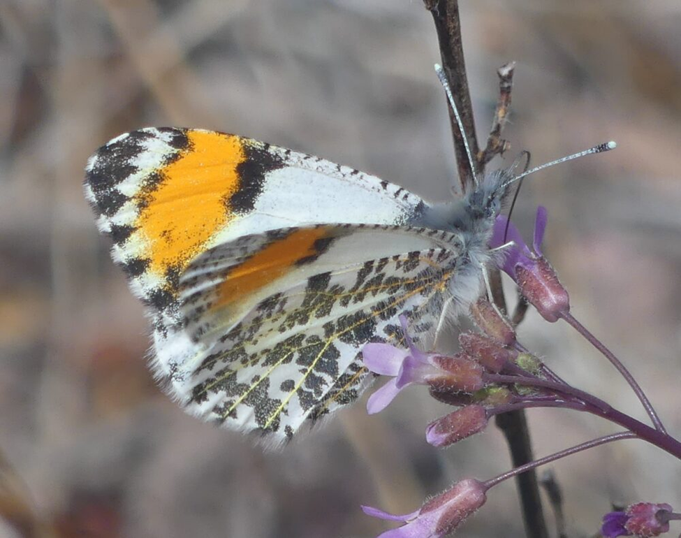
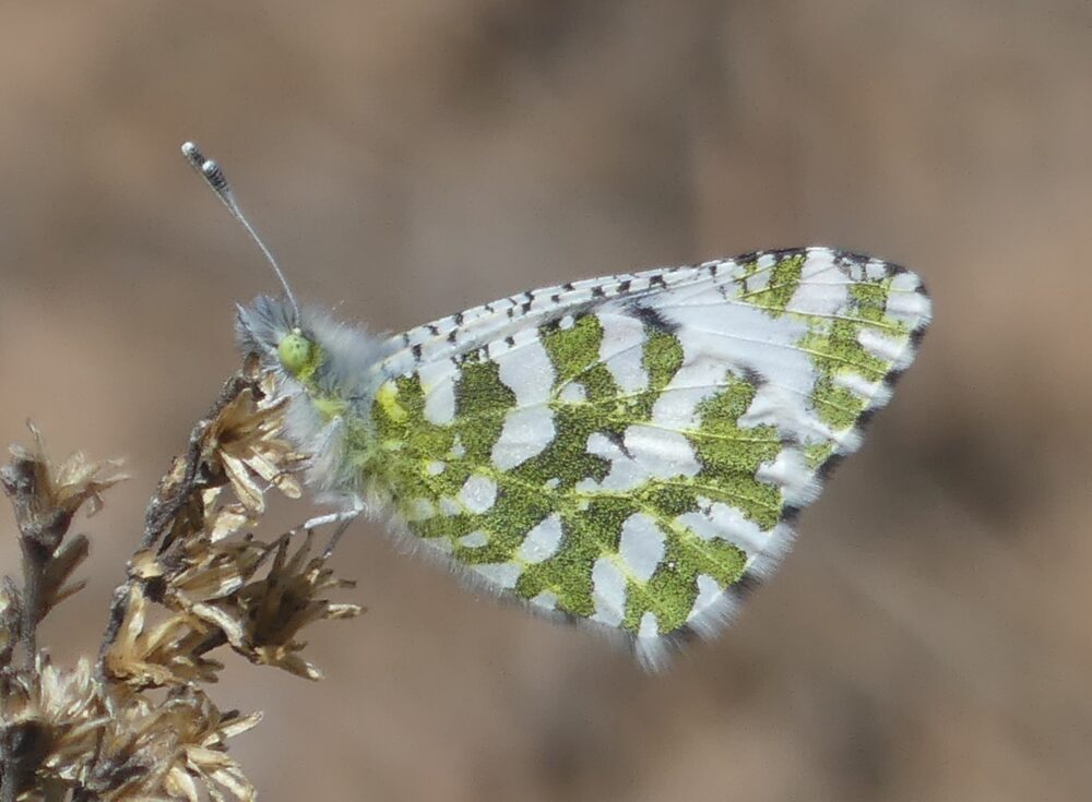
I stopped to snap some pictures of the striking landscape: bare rock with trees sprouting from cracks; and looking southwest across the Ri0 Chama well below to the Jemez on the horizon. Just then came along another small Pierine which dodged erratically before me about three feet above the ground. It paused between flaps just long enough for me to see the orange forewing apex of an Orangetip.
One glance in BofNM at distribution maps for Southwestern Orangetip and Rocky Mountain Orangetip reveals that we have little data and little understanding about orangetips in northwest New Mexico. We have one data point for Rocky Mountain Orangetip in extreme northwestern Rio Arriba County near Dulce, and a couple of data points for Southwestern Orangetip elsewhere in Rio Arriba County. Frankly, we do not know which of the two species we have or where they occur. This is one reason for my forays into this region so early in the season.
In the Pygmy Forest, this particular solitary Orangetip dodged and danced with remarkable perseverance. With my camera at the ready, I moved as the butterfly moved, following 5 to 10 feet behind as it meandered through the local landscape. It went around one tree clockwise, then around another counterclockwise. It occasionally contemplated a blooming mustard, but thought better of it and fluttered ahead into sunny patches, then through the trees again. In my mind’s eye, I saw an arthritic naturalist stumbling behind, with one eye on the butterfly and another on the semi-shrubby terrain through which I was quickly walking. This went on for at least ten minutes, the Orangetip never settling, but never leaving me in the dust, either.
I was losing track of where we were, losing my sense of direction. Then as I galumphed after this beast around yet another juniper, it swerved right and seemed to fly into the juniper. I pulled up suddenly, about five feet from the edge of the rim which dropped 300 vertical feet to the Rio Chama. Phew. Now where was that little guy, with well-camouflaged underside and giving me nothing but wing edge? The only way to locate it was to make it fly, which it proceeded to do, dancing away from me with greenery to the right and gorge rim to left. Alas, it had earned its freedom from my prying eyes; I threw in the towel.
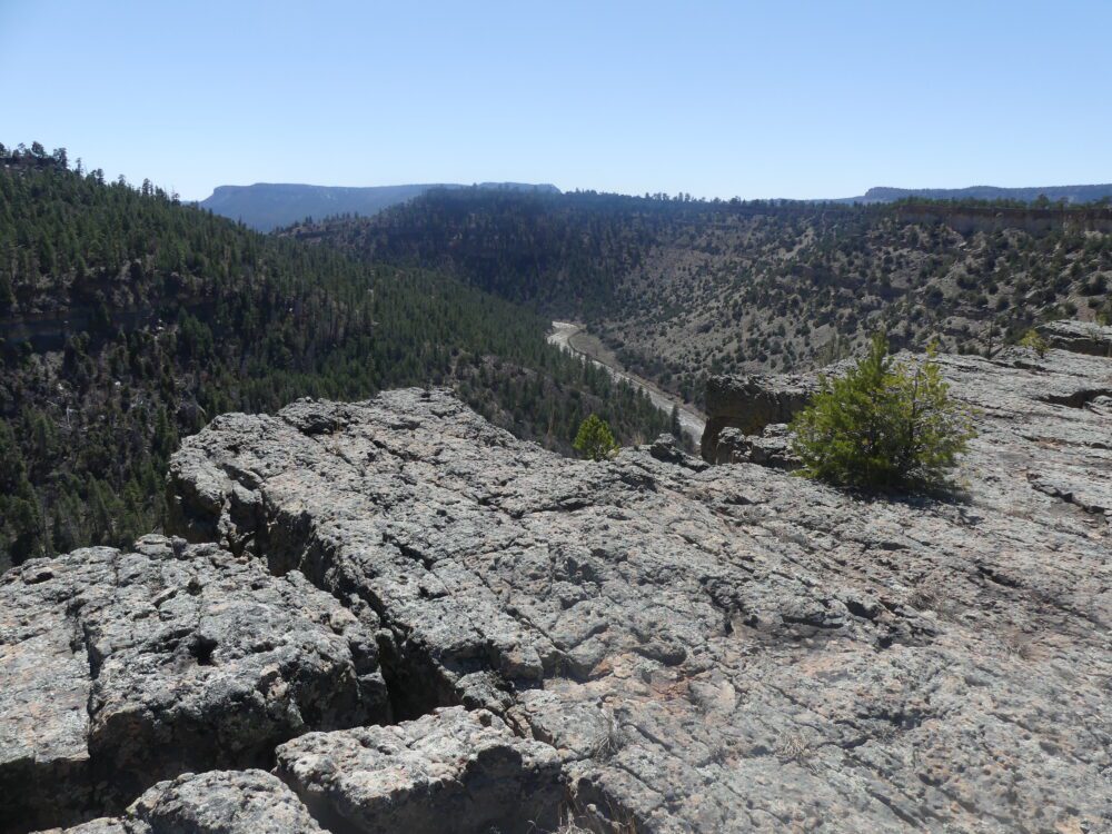
The rim overlooking upper end of the Rio Chama gorge
Turning back to the north I began to wander back in the direction of my truck, while seeking patches of sun and nectar. It was approaching 3:30, which is rather late on a spring day. Temperatures were still pleasant, but I suspect butterflies are just as sensitive to temperature trends as they are to the actual temperature of the moment. Cooling air was the cue to find a place to spend the night. I did see a couple of Nymphalids flying my way, a Painted Lady and some commas, which eventually resolved themselves into Hoary Commas.
In sum, a migrant, some hibernators, and a few interesting spring emergers made a nice butterfly medley on a mild mid-April day in north-central New Mexico. That Orangetip is still out there, though. Perhaps one of you will give it a look and help us figure out which of these two orangetips make their homes in this part of New Mexico. I’ll certainly try again next year.