Craig Martin’s Recommended Hike for Early November
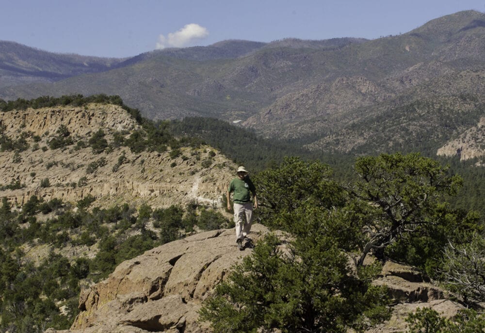
Deer Trap Mesa offers what for Los Alamos is an easy 3-mile hike that is perfect for sunny afternoons in the fall. Lingering autumn pastels, views of the entire length of the snow-capped Sangre de Cristos, and a good chance to see raptors make this a great time for the trip.
Easy for Los Alamos? Well, the trail is mesatop-flat, except for two staircases carved into the soft tuff. The first, only a few hundred feet from the trailhead, has likely been used for centuries, or at least from the development of Barranca Mesa in the 1960s. It’s steep and a bit tricky, but most hikers won’t have a problem with it.
The second staircase is less than a year old. It was constructed, complete with well-placed rock “handrails,” by the Family YMCA Youth Conservation Corps this past summer. It’s easier to descend than the older stairs, and opens up another half mile of easy hiking on the mesa beyond.
From the trailhead, walk to the end of the pavement and pick up the trail as it threads along a narrow neck of the mesa. For a bit of a history lesson, stop and check out the Homestead Tour markers that face in the direction of four homesteads that were in the area a century ago.
Where the thin finger of the mesa abruptly ends, descend the well-worn staircase. At the base, at a slice through the mesa, is the deer trap for which the mesa was named. It’s a shallow pit designed to trap game driven from the narrow Barrancas Canyon to the east.
Traverse along a bench below the cliff for a 200 feet to where a well-placed arrow trail marker points to the way back to the mesa top. Another short and easy climb and you are back on top.
The trail—worn into a shallow rut—winds through juniper woodlands with great views the entire way. Red-tail Hawks often catch the air currents and sail close overhead. Orange cliffs of Bandelier tuff—the stuff of the Valles Caldera eruptions—step off to the north.
A bit more than a half mile into the hike, a trail to the right heads off to the south arm of Deer Trap Mesa. The current trip takes the left fork to reach a viewpoint at the one-mile point. (The trail to the right forms a loop to the south arm.) Cairns mark a route off the point to the east to the obvious trail continuing below. Reach the second staircase in a few minutes, descend and follow a winding trail to the next saddle.
From this saddle, the trail continues to the left and leads to Rendija Canyon. But an unimproved route continues along the mesa top. The first stretch is easy, then a bit of boulder hopping is required to continue. The rocky mesa top is fun to explore, and the views are great. A bit past the powerline that crosses the ridge is the unmarked boundary of San Ildefonso Pueblo where entry is prohibited, so the powerline is a good turnaround point.
Reach the trailhead by heading left at the roundabout on Diamond Drive just past the golf course. Continue right onto Barranca Road where San Ildefonso Road makes a funky left. Pass Barranca Elementary and in a minute, continue straight and park at the dead end near the Road Closed sign.
Photo by Craig Martin.