Enjoy a December mini-adventure on the Mitchell Trail Loop mud and ice.
That’s the condition of most local trails in December as we await a covering of snow. Finding a hike after 10 AM that keeps your boots clean and doesn’t inflict a lot of damage to the trail is a challenge, but there are a few trails with rocky treads and south-facing exposures that can help ward off cabin fever.
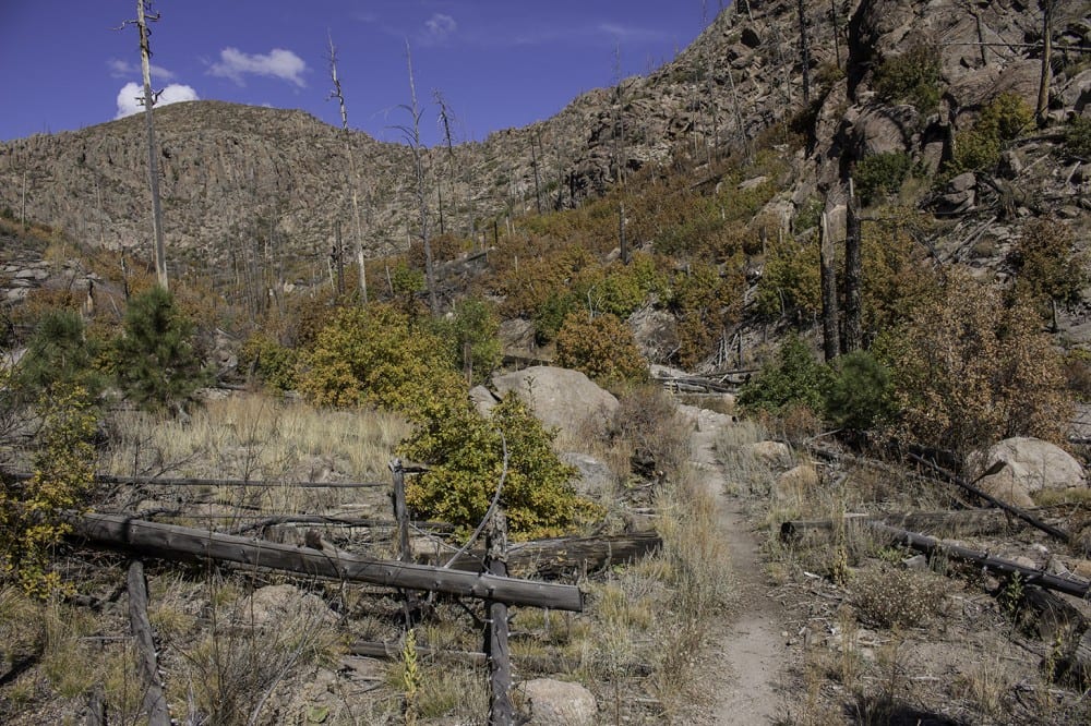
The Mitchell Trail Loop combines a ridgeline trail with an abandoned but still nice route to offer a two-mile, almost mud-free trek. Highlights include views of the Natural Arch, some impressive rock cliffs, and a fascinating look at the power of post-fire floods. The first half of the trip is on the PEEC Los Alamos Trails app (called the Rendija Canyon hike), so if you haven’t given the app a try, go for it!
The trail heads uphill from the information kiosk, located where 45th, Yucca, and Arizona streets come together in North Community. At the top of the first hill, cross a dirt road, drop into Rendija Canyon, and angle left where the Perimeter Trail heads right. There’s a forest of ponderosa pine saplings along the trail—some 12 feet tall—all planted by volunteers in the spring of 2001 and now thriving on the north-facing slopes.
Cross the gravel channel of the south fork of Rendija Canyon, and in a few yards, turn left at the sign for the Mitchell Trail 69 (not miles, but the Forest Service trail number). Some steep and narrow switchbacks lead to the ridgeline above the main Rendija Canyon. The trail follows a dozer line created during the 2011 Las Conchas fire. As you travel this stretch, watch for the Natural Arch on the skyline to the right. Oaks and small pines line the trail. To the south (left), there is a rather dense forest of young saplings.
After about a mile, the trail descends on newer switchbacks to the canyon bottom. A sign points to the Mitchell Trail as it ascends to Guaje Ridge, but for this trip, ignore the sign and head down the canyon channel to the right. There’s not much of a trail here, the trail having been rebuilt and washed out numerous times following post-fire floods. The Forest Service decided to not maintain this route, but it is easy to follow, a fun mini-adventure, and sections are maintained pretty well by trail fairies. The route stays in the channel for about 300 feet, then the old trail angles off to the left and leads all the way back to the Mitchell Trail junction.
See, there’s no excuse. Get outside for a hike!
Photo and article courtesy of Craig Martin.
Our thanks to the trail fairies for clearing the lower section of this trail. The Gentle Walkers were headed for the Perimeter Trail, but based on this entry, we opted for the Mitchell Trail. We went counter-clockwise (took the “low road” that followed the old drainage by taking the right trail fork at the first “Mitchell Trail 69 “trail sign). The last time I waded through there, the locusts made it it…um…unpleasant. Now, it’s a great walk…good trailbed, lots to see (great interaction between ravens and 3 hawks that outsmarted them), and the well-marked turnoff to the Natural Arch. We continued on west to the intersection with second “Mitchell Trail 69” sign, then climbed the well-placed switchbacks to the ridge. Coming down the steep, narrow switchbacks mentioned above, we decided we prefer the counter-clockwise direction we went…the new switchbacks west of the arch are much more user friendly for gaining the top of the ridge. The views coming down the ridge line were breathtaking.