Length: 3 miles roundtrip
Elevation Gain: 300 feet
Difficulty: Easy
Suitable For: Hiking and running only
By Craig Martin
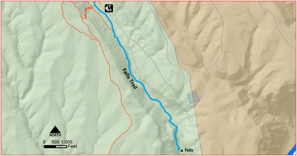
The Falls Trail in Bandelier National Monument makes a delightful, scenic outing for families or any hiker. The trail has sun and shade, running water (most of the time), ferns and wildflowers, and ends with a view of a spectacular waterfall. Much of the trail is shady, covered by ponderosa pines. Before the post-Las Conchas fire floods in 2011, the trail continued beyond Upper Falls to Lower Falls and from there to the Rio Grande. But the floods wiped out the trail and collapsed the surrounding cliffs so that no route through has been re-established. The old trail beyond Upper Falls is closed and hazardous.
The trip is relatively easy but does involve a 300-foot climb back from the falls along gentle grades. Also, much of the trail is on a bench high above the canyon bottom. This is particularly true in the last quarter mile before the falls, where careful supervision of children is highly recommended.
Finding the Trailhead: From the entrance to Bandelier National Monument on New Mexico Highway 4 south of White Rock, take the entrance road toward the Visitor Center, descending into Frijoles Canyon. About 200 feet before the visitor parking area, turn left, following signs for Cottonwood Picnic Area. Park your car in one of the first open spots you see. If you have an annual pass, display it through your windshield, or walk to the Visitor Center and purchase a day pass.

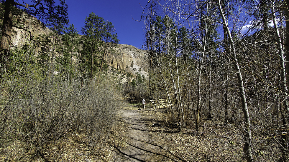
The Falls Trail begins at the far east end of the Cottonwood Picnic area parking. The first section of the trail is level or gently rising and the path is wide and easy to follow.
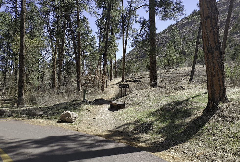
The Trail: From the parking area, walk down the road you just drove on for a minute. Signs point to the Falls Trail angling uphill to the right.
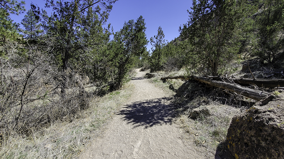
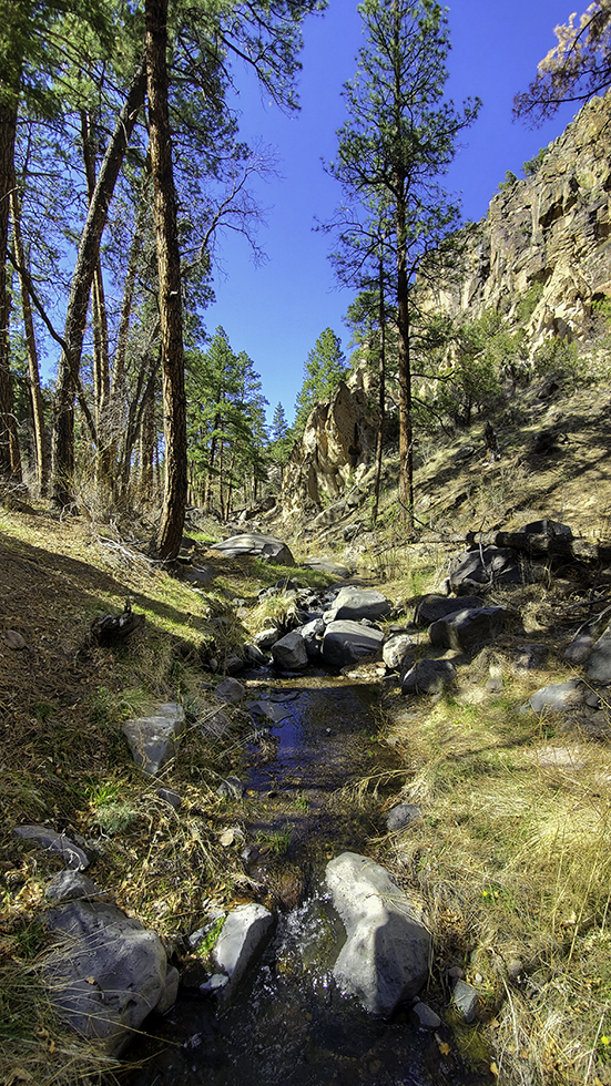
Pass a trail heading right and continue straight along a wide dirt path, with Frijoles Creek in the canyon bottom on the left. Passing through junipers and piñons, the trail is sunny and can be hot in summer.
After ten minutes or so, the trail begins to descend toward Frijoles Creek. Tall pines shade the trail, and ferns grow on the rocks along the trail. Soon make the first crossing of Frijoles Creek on a log bridge.
Basalt cliffs rise to the left of the trail as it passes through the shady pine forest. In summer, watch for orange milkweed under the pines. Willows and tall narrowleaf cottonwoods grow along the stream. Soon come to a second, newer bridge and again cross the stream, with towering orange cliffs all around.
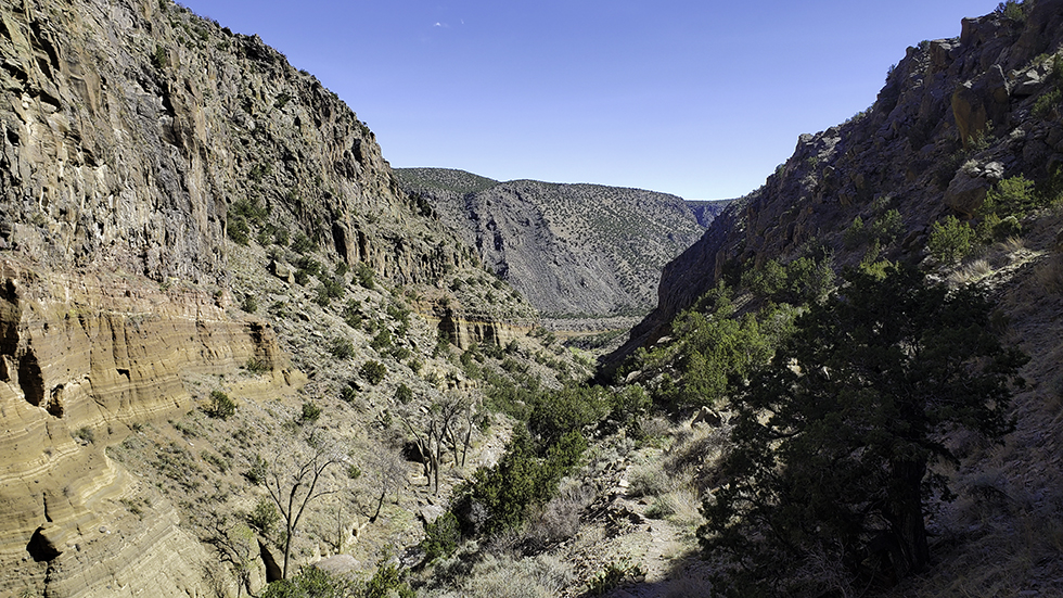
As the trail moves away from the stream, pines again dominate. In a few minutes, ascend a sloping section of trail that quickly rises above the canyon bottom. At the top of the hill, turn a corner and enjoy the view down to the Rio Grande along Frijoles Canyon.
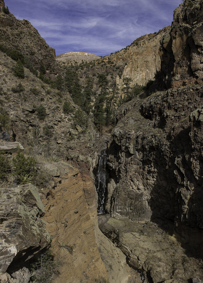
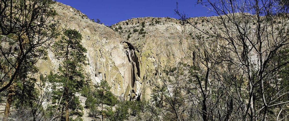
Beyond the corner, the trail descends as it clings to the cliff high above the canyon bottom. Supervise children carefully as you wind past banana yuccas and Mormon tea. Soon round one more turn to reach a viewpoint of Upper Falls.
The old trail is visible from this location, but it is unsafe to continue further. Enjoy the view, then return to the trailhead by the same route.
Extensions: None.
My adult daughter and I hiked to the Upper Falls this past Friday. What a delightful hike! We took our lunch and had a picnic under a big Ponderosa. The view down to the Rio Grande was indeed grand! If ever there are any plans to try to restore the trail to the Lower Falls and on to the Rio she and I would be up for volunteering for some trail building or maintenance.