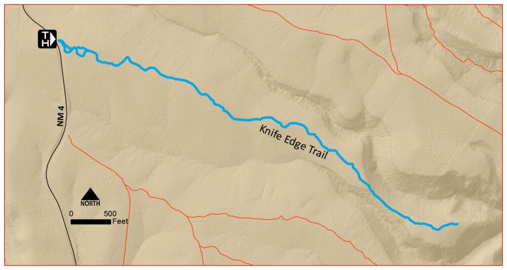
Length: 2.4 miles roundtrip
Elevation Gain: 150 feet
Difficulty: Easy
Suitable For: Hiking only, good for families with children under supervision.
By Craig Martin
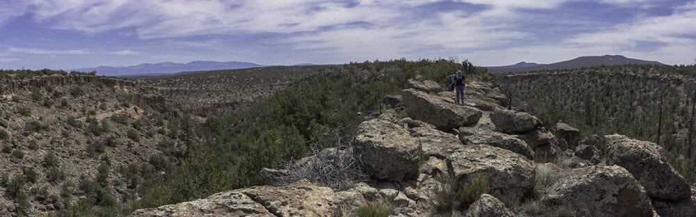
The Knife Edge is a narrow ridge of rock separating two branches of the Ancho Canyon drainage. The ridge narrows to become only a few yards wide, offering nice views in both directions. The trip is an easy walk on an old dirt road through piñon and juniper woodlands, and in spring you can find some early wildflowers growing along the way. It is a nice outing for families and a great early-season trip for anyone.
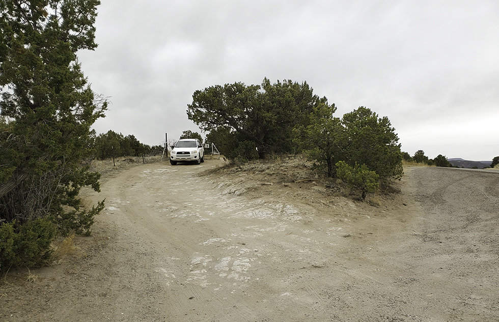
Finding the Trailhead: From the traffic signal at the intersection of New Mexico Highway 4 and Rover Boulevard in White Rock, head south on Highway 4 toward Bandelier National Monument. Continue about 4.5 miles to a small parking area on the left (east) side of the highway marked Gate 3. A trailhead kiosk just inside the fence identifies this as the Knife Edge Trailhead.
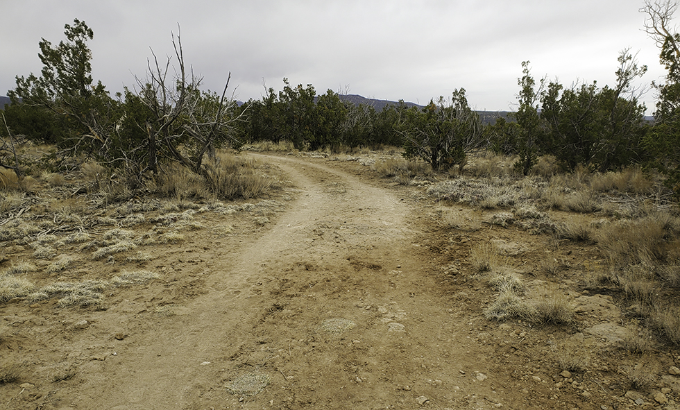
The Trail: From the parking area, pass through the hikers’ gate and check out the trailhead kiosk. Head east on a winding road that at first alternates between gravel and dirt surfaces.
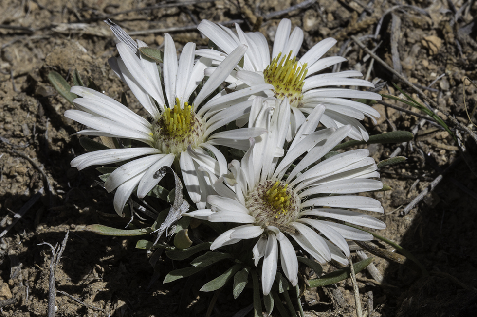
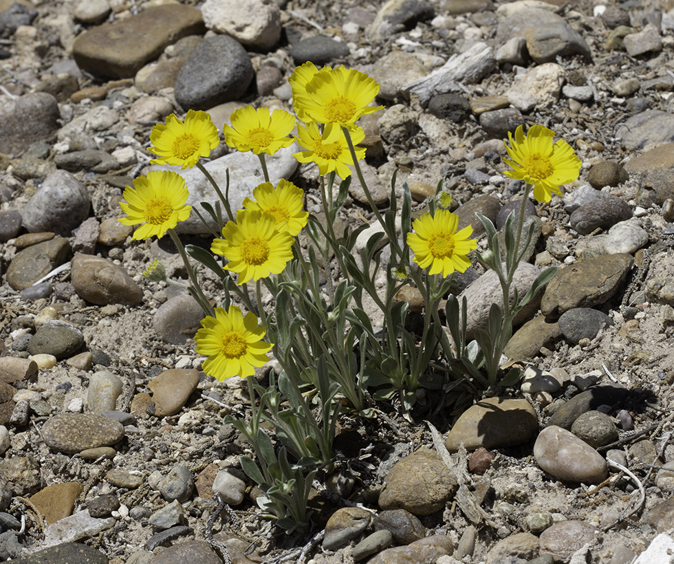
As the trail winds through the trees, watch for early-season wildflowers growing in the rocky soil. Easter Daisies and Perky Sue are particularly common in the woodlands.
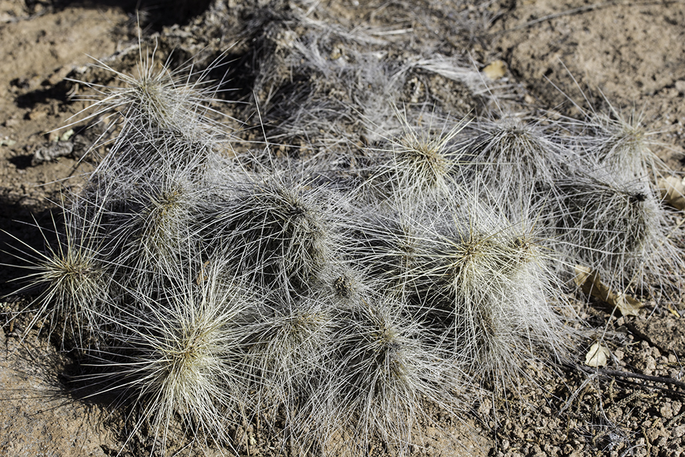
In a half-mile, cross under a powerline and continue on the twisting trail heading toward the Sangre de Cristo Mountains. About a mile from the start, the old road narrows to a single-track trail that is still easy to follow. Large patches of long-spined plains prickly pear cactus are found in the bare soil on either side of the trail.

In early April, small mounds of Easter Daisies grow along the trail. Perky Sue adds a splash of yellow among the rocks. The hairy-looking plains prickly pear cactus grows in large patches along the trail.
A few minutes beyond the end of the road, the trail comes upon the narrowest, rockiest section of the ridge, the Knife Edge. It’s fun to boulder hop along the ridge, enjoying the views of the two adjacent canyons.
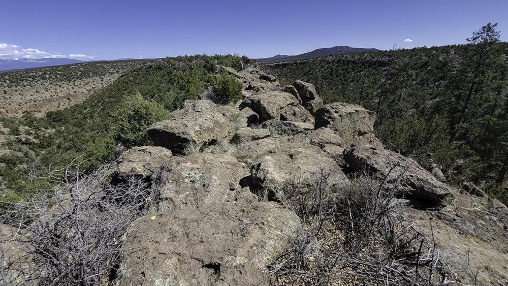
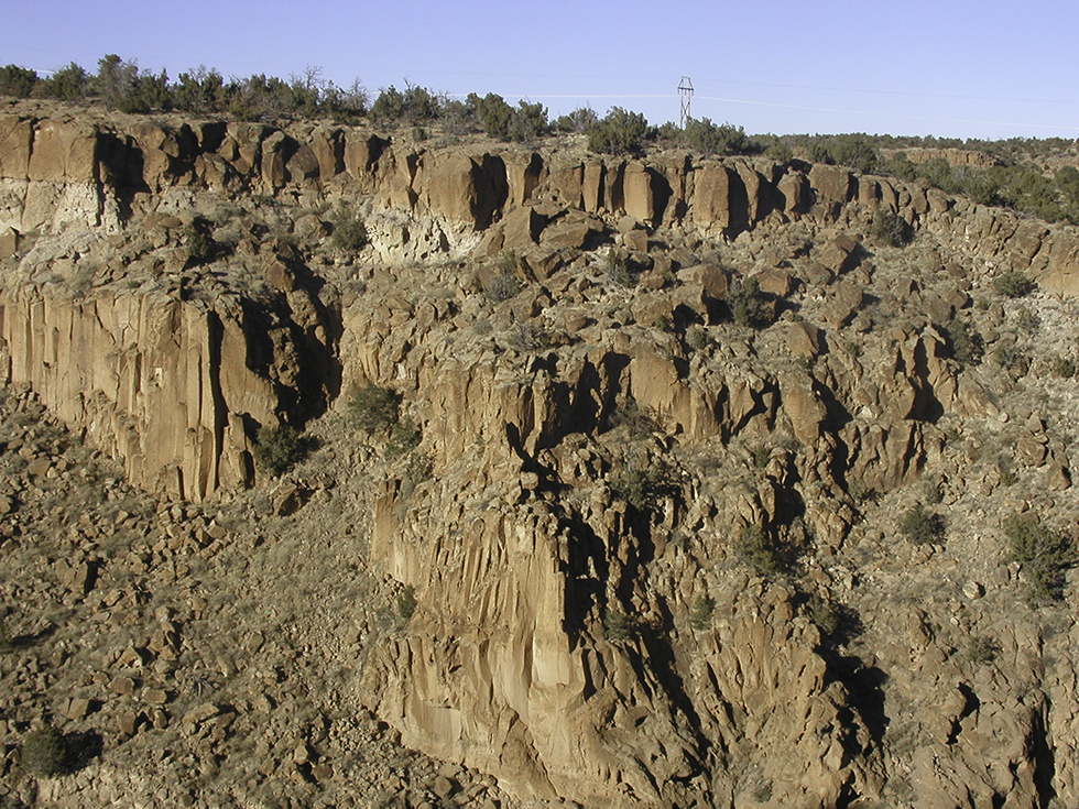
Continuing along the ridge to the east, the trail reappears beyond the exposed rock along the Knife Edge. The mesa top is wider as it approaches the cliffs above branches of Ancho Canyon.
The trail peters out as the terrain begins to slope steeply into the Ancho drainages. Look for red foothills paintbrush and yellow western wallflower growing among the rocks. Enjoy the sweeping views, then return to the trailhead by the same route.
Extensions: If you have some route-finding skills, you can drop off the Knife Edge to the south and explore the canyon. It is possible, but slow going, to return to the trailhead by heading west up the canyon. A GPS helps with navigating this route.
This is one of my favorite trails. The first time I hesitated to go forward on the boulders. But the trail improves after the narrow part. So close to Pajarito Acres.