By Steve Vrooman, Keystone Restoration Ecology & Siobhan Niklasson, PEEC Education Programs Director
The surface water that flows through riparian areas allows them to support a high diversity of life, but the water can also be a liability. Our climate in Northern New Mexico, with its long dry spells interspersed with intense monsoon rains, means that riparian areas must deal with large variations in the availability of water.
A healthy system with native vegetation is well adapted to these variations and can thrive under natural conditions. But human development and giant wildfires exacerbate the stressors in these areas, and sometimes leaves them unable to cope with the wild swings in water availability we have seen in recent decades.

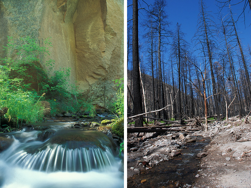
Fire is an extreme example. The 2011 Las Conchas Fire wiped out the forest in the Frijoles Creek watershed in Bandelier National Monument. With nearly all of the vegetation killed on the steep slopes leading to Frijoles Creek, the monsoon rains flushed tons of soil, rocks, trees, and other debris down the canyon and devastated the riparian area. This video taken near the Visitor Center at Bandelier National Monument in 2013 shows the effect of flash flooding in the canyon, when an unusual rain event combined with the fire-damaged watershed.
Even milder disturbances can have a big effect. Buildings and streets don’t absorb water the way plants and soil do, so when rain falls on urban areas, much of it runs off into our canyons. Graduation Canyon close to downtown Los Alamos is an example.

One of this post’s co-authors, Steve Vrooman of Keystone Restoration Ecology, remembers that when he was growing up in Los Alamos, there was water in the creek in Graduation Canyon year round. But the same 2013 rain event that caused the flash flood in Frijoles Canyon also washed away the soil in Graduation Canyon and left it stripped to bedrock.
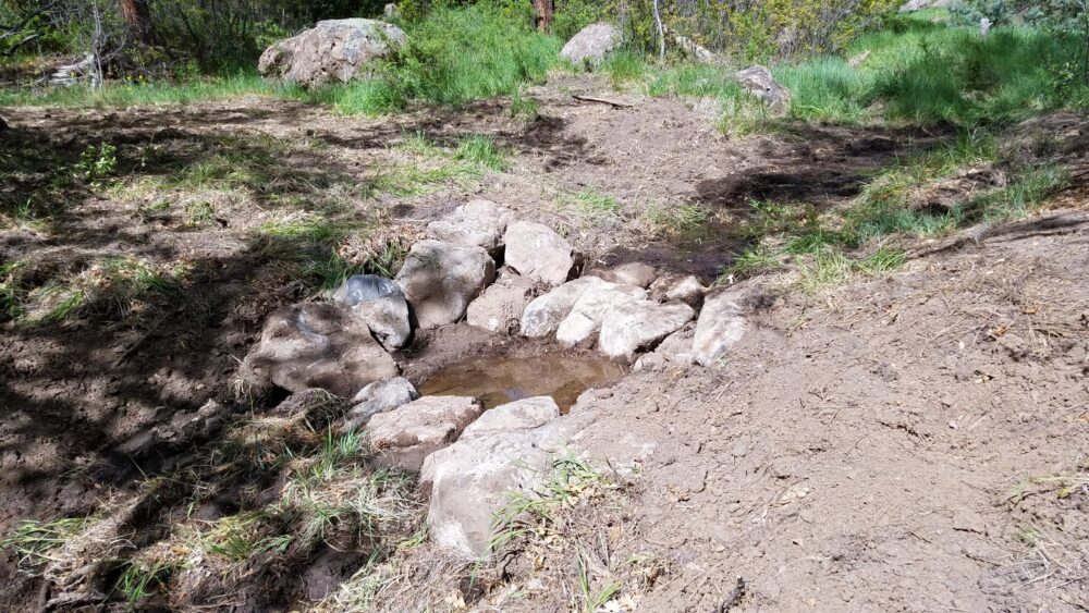
Los Alamos County decided to try to restore the canyon’s riparian area. The project was designed by NCD Engineering in Flagstaff, and built by Keystone. They worked entirely with natural materials to create structures to slow and spread water, and help it spread onto the floodplain during large floods.
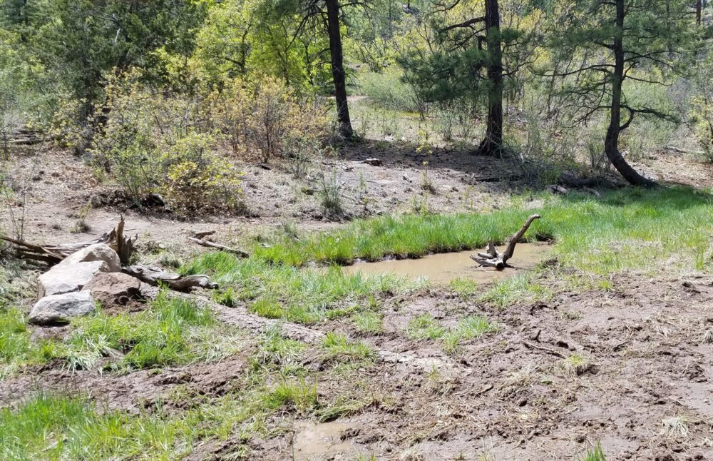
They stopped erosion and ponded water to reestablish wetland plants, which further slow down and absorb water.

Now the wetland is back, the water table more or less permanent, and wetland plants are spreading throughout the canyon.
You can look for signs of restoration efforts in canyons throughout Los Alamos and the region. Walk along the Graduation Canyon Trail and look for:
- Stabilization structures like the ones pictured above
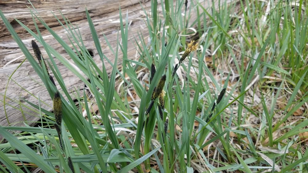
- Wetland plants
- Signs of flowing water
- Sounds and glimpses of amphibians, like canyon tree frogs
- Scat or tracks of other wildlife
Other canyons in Los Alamos have also been restored. Check out Upper Pueblo Canyon and Upper Los Alamos Canyon to identify bigger structures.
If you want to get involved, Keystone Restoration Ecology will be posting volunteer opportunities at workshops at Ghost Ranch this fall with the Albuquerque Biopark, and restoration workshops at the Valles Caldera with the Rio Puerco Alliance.
For more information about the Graduation Canyon project, see this article from the Los Alamos Daily Post.
