Length: 1.5 miles roundtrip
Elevation Gain: 300 feet
Difficulty: Moderate, mostly because of the ladders
Suitable For: Hiking only, good for families with children under close supervision
By Craig Martin
If you are looking for a scenic trail with plenty of cultural resources and scenic vistas to enjoy, then check out the Tsankawi Loop Trail in the detached section of Bandelier National Monument near the intersection of the Truck Route and New Mexico Highway 4 north of White Rock. Because the trail is at a relatively low elevation, snow and mud dry out quickly, making this a good late winter destination.
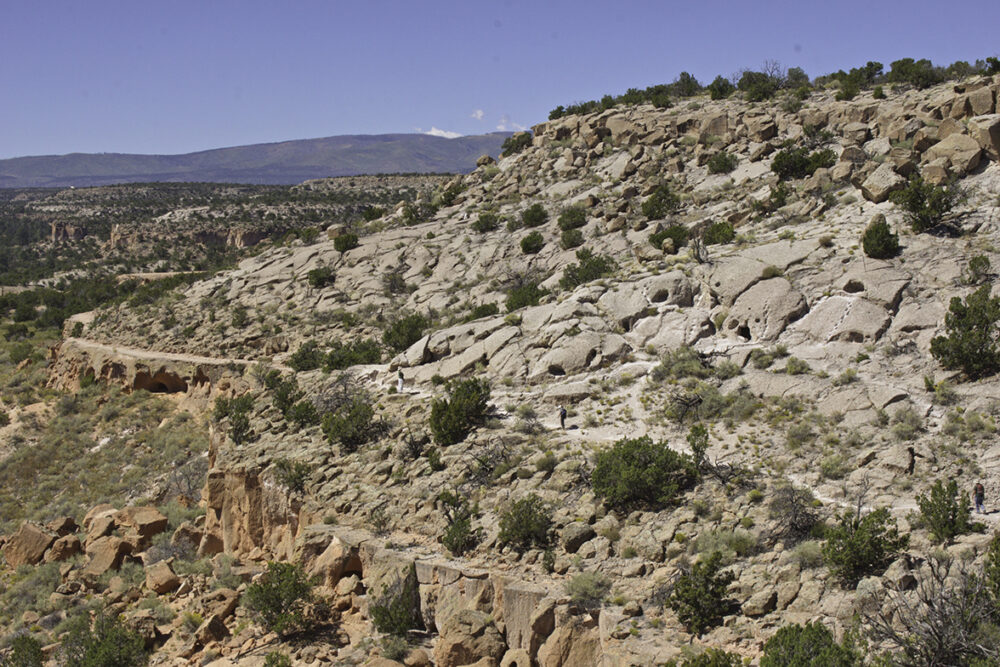
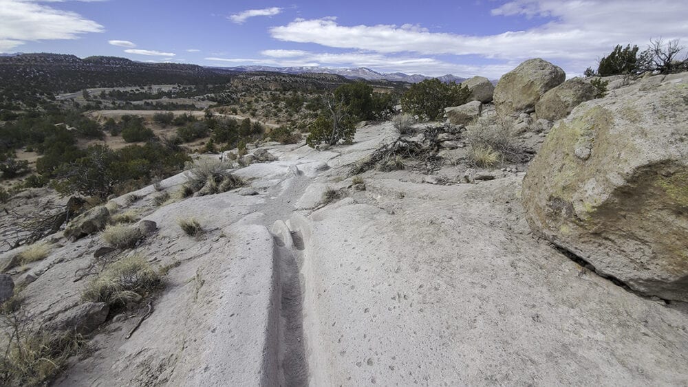
Along the 1.5-mile loop you’ll find Ancestral Pueblo footpaths, petroglyphs, stunning 360-degree vistas, and a huge pueblo abandoned about 400 years ago. The entire trail is on the soft volcanic rock called tuff and some of the foot-worn passages along the trail are amazing. Although it is a short and relatively easy hike, there are several challenges along the way, including ladders, narrow passages in the soft rock, and steep trailside drop offs. A Bandelier pass is required for hiking, either an Annual or Senior pass or a seven-day $25 park entrance pass. No pets, bicycles, or horses are permitted, and the trail is not inviting for snowshoes or cross-country skis.
Finding the Trailhead: From the intersection of Diamond and Trinity in Los Alamos, head south over the Omega Bridge on Diamond Drive. Get into the left-hand lane, and at the traffic signal continue straight past the County Ecostation, now heading east on East Jemez Road, also called the Truck Route. Continue about five miles to the next traffic signal and turn left onto New Mexico Highway 4. The parking area is immediately on the right. Or, take Trinity Drive and East Road past the airport in Los Alamos and wind downhill to the Y intersection, bearing right toward White Rock. Merge onto New Mexico Highway 4 and in a half mile, find the parking area on the left. From White Rock, head toward Santa Fe on Highway 4 and in 2.5 miles, just past the traffic signal at the intersection with the Truck Route, find the parking area on the right.
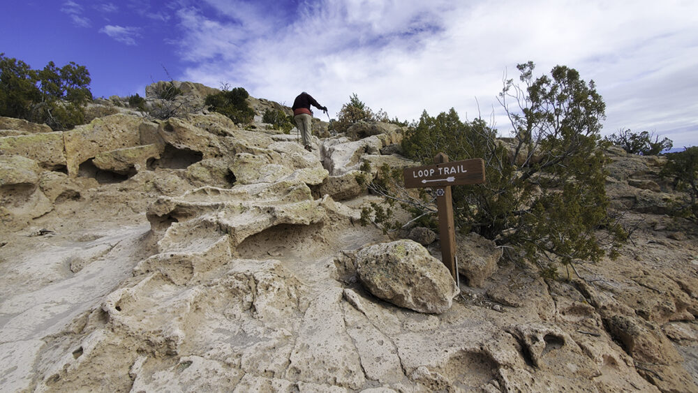
The Trail: After displaying your pass or entrance receipt on your dashboard, follow the trail signs heading east, passing a park building and a trail information kiosk. Pick up a trail guide here, then head uphill through juniper and piñon, enjoying the orange-tinted, pock-marked cliffs to the left. After a couple minutes, climb the first ladder to reach a level rock surface.
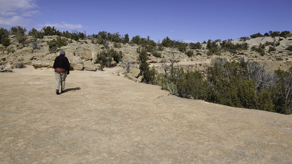
Cross the flat rock and pick up the trail to the right. Traverse along a flat bench for a few minutes, then angle left to begin the loop to the mesa top.
Follow the trail over the rocks, following the lighter colored rock where the orange patina has been worn off by the passage of hikers over the years. In some places the trail is worn a foot or more deep into the soft rock.
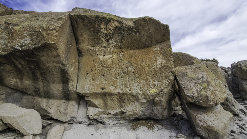
Next you have a choice of climbing through a deep, narrow passage through the tuff or skirting to the right where another ladder offers an alternate route to the next level. You soon come to an impressive petroglyph panel featuring two large human figures saying hello.
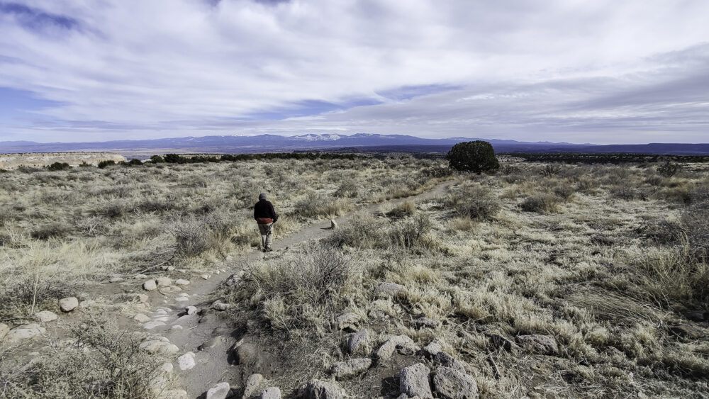
When you reach the mesa top, enjoy the 360-degree views of the adjacent mesas, the Jemez Mountains, and the Sangre de Cristos … this is one of the best vista points in the eastern foothills of the Jemez Mountains. Now walking on the level mesa top, you soon come to Tsankawi Pueblo. The unexcavated pueblo walls rise as low mounds on the mesa, but you can easily see the shape of the village and the locations of the below ground ceremonial chambers called kivas. Respect and protect the site by staying on the trail through the village, and if you spot a black-on-white patterned pottery sherd, enjoy your discovery but leave it where you find it.
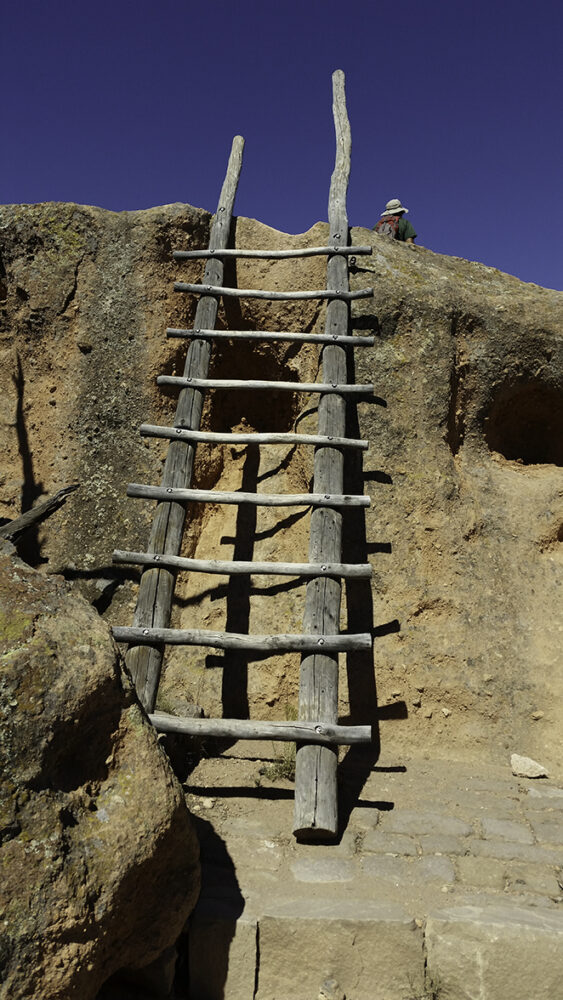
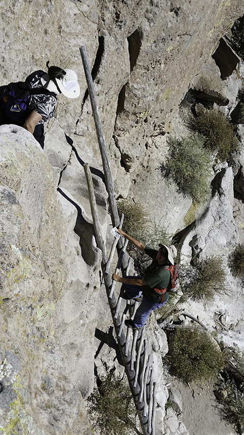
From the village, drop down a bit to the mesa rim and follow the sign to the next challenge, a 25-foot ladder that takes you down to a collection of cave rooms. This ladder requires some caution, especially if you have children hiking with you. If it seems too much for your abilities or comfort with heights, you should turn around and return by the same route. But it’s really not as bad as it looks!
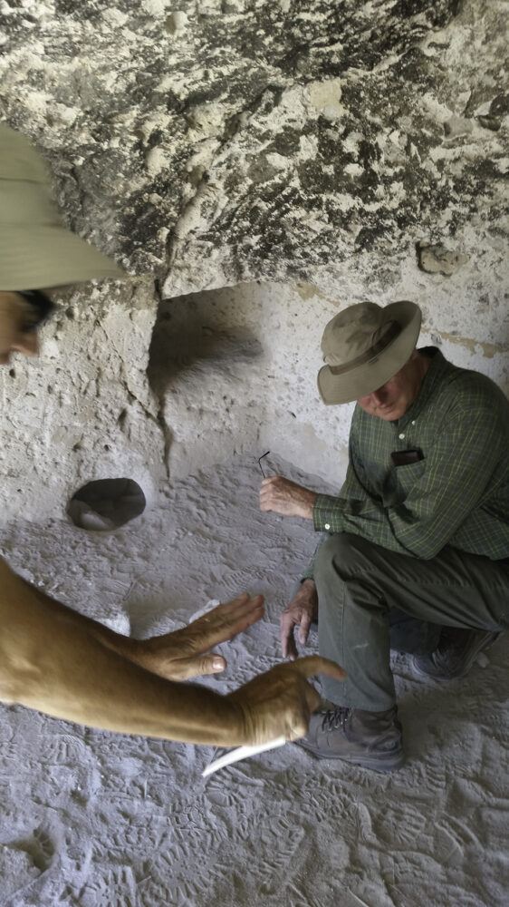
Along the bench at the base of the long ladder, explore several cavates with fire-blackened ceilings. Also, enjoy looking at the Ancestral Pueblo stairways that offered a route from the pueblo to the cavate dwellings on the bench.

The long ladder might be a challenge for children or anyone with a problem with heights, but it is a fun section of trail. Inside one of the cavate rooms with the ceiling blackened by fires several centuries ago.
The second half of the loop leads through more tuff formations, passing more petroglyph panels, and gradually descending through white tuff to the top of a more resistant, orange-colored layer. There are some fun chutes through the white tuff before reaching the flat orange bench. Follow the bench back to the first ladder, descend, and reach the parking area in a few minutes.
Extensions: None.