By Jean Dewart
Let’s go back, to a time “before clouds.” The air is primarily made up of gases — oxygen and nitrogen — that are invisible to our eyes. Oxygen is about 78% of the air and nitrogen is about 21% of the air. That accounts for 99% of the air! So, the rest of the atmosphere is made up of trace gases that can change depending on time and place.
One of these trace gases is water vapor — that is, water in its gaseous form. It turns out that Earth is the “goldilocks” planet (that is, it’s just right!) because at the temperatures found on the earth’s surface and in the atmosphere, water can exist in each of its three phases: gas (water vapor), liquid (water), and solid (ice).
Our atmosphere has water vapor in it all of the time — sometimes only a little and sometimes quite a lot. Relative humidity is one way to describe the amount of water vapor in the air. If there were no water vapor in the air (this rarely, rarely happens, and only in very, very cold weather), we describe this as 0% relative humidity. If the air had as much water as it could hold, we describe this as 100% relative humidity. The air in Northern New Mexico is usually between 30% and 60% relative humidity near the surface of the earth.
How does water vapor get into the air? Primarily from evaporation of liquid water from the oceans, rivers, and lakes of the world. In Los Alamos, where we’re far from major bodies of water, water vapor is brought by the winds coming from the Pacific Ocean, the Gulf of Mexico, or the Sea of Cortez (Gulf of California).

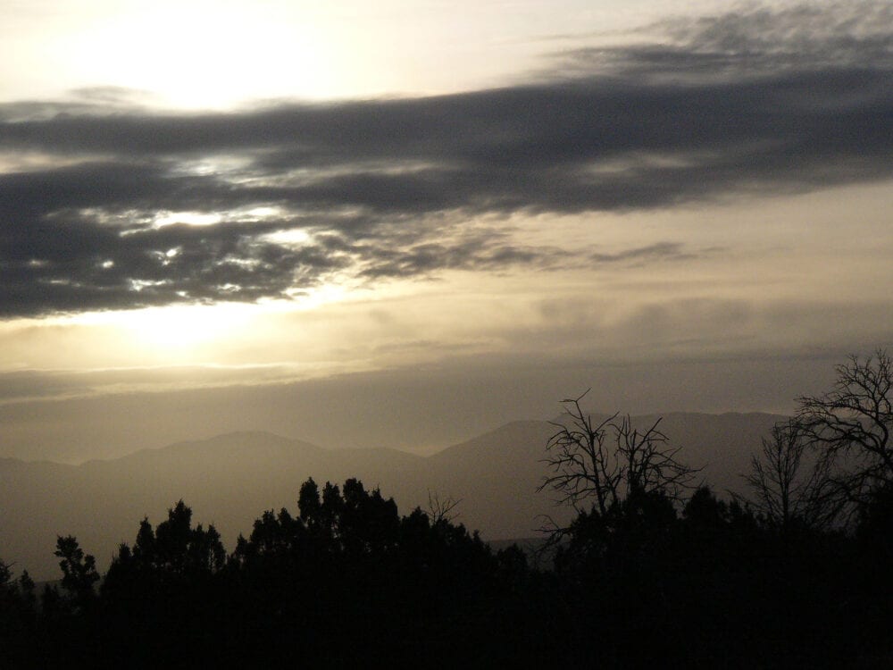
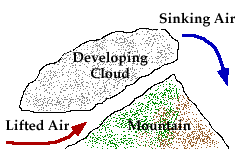
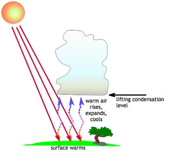
For a cloud to form, the air must have 100% relative humidity. This allows the water vapor (gas) in the air to condense into liquid water. To get air to 100% relative humidity, the air must usually be cooled. Air can be cooled by lifting it above the ground — sometimes to as high as 20,000 ft above the ground! Air at the earth’s surface can be lifted by winds hitting a mountain (topographic lifting), by a cold front, or by the sun warming the ground and heating the air next to the ground.
In each case, air will rise (and cool) to a height where the relative humidity is 100% and cloud drops begin to form. If air is lifted high enough, the air can cool enough to form ice crystals instead of water droplets.
Here are the different types of lifting of air in the atmosphere.
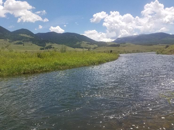
Example of topographic lifting of air to produce clouds:
Example of a cold front lifting air to produce clouds

Example of surface heating of air to produce clouds:
What clouds did you see today?

If there is rain, then it is a cumulonimbus or nimbostratus cloud. Which one is this?
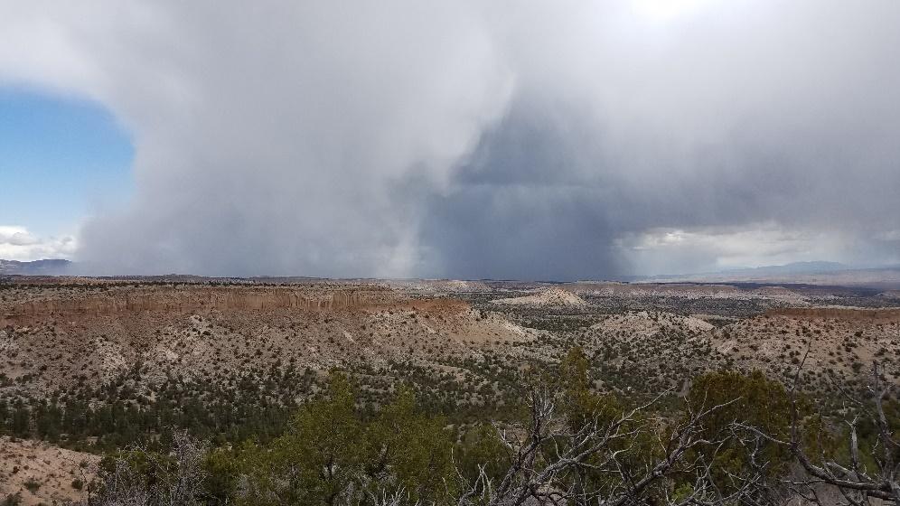
Although you cannot see the top of the cloud in this photo, the rain being organized into a shaft indicates that this is probably a cumulonimbus cloud. Nimbostratus clouds usually have widespread rains, coming down from many parts of the stratus cloud, rather than in distinct shafts as in this photo.
The World Meteorological Organization has developed a classification of cloud types. To see this, and learn a lot more about clouds, visit their webpage.