Length: 3.2 miles roundtrip
Elevation Gain: 200 feet
Difficulty: Easy, with one tricky section
Suitable For: Hiking only, good for families with children under supervision.
By Craig Martin
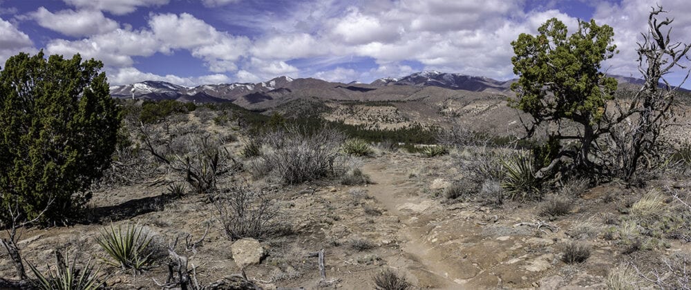
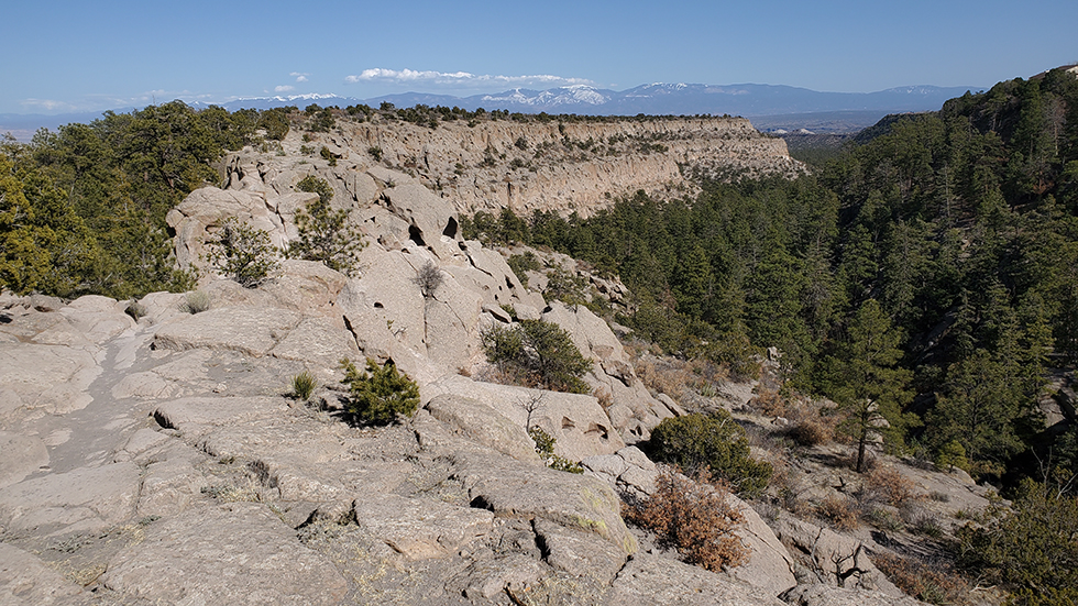
One of the finger mesas extending east from the Pajarito Plateau, Deer Trap Mesa offers the most consistently scenic hikes on the plateau. In addition, the terrain is rather flat, with a couple of exceptions. The main trail passes by the game pit for which the mesa was named, then follows a well-worn path across a narrow section of mesa with views on both sides. A loop trail, located on Los Alamos County Open Space, leads to several overlooks of the Pajarito Plateau and Sangre de Cristo Mountains to the east. The view is constantly changing, and immensely enthralling. The most challenging section of trail is in the first 100 yards, a short, narrow, steep descent on an Ancestral Pueblo stairway that seems tricky but is rather easy and not dangerous if carefully navigated. Almost the entire canyon edge trek follows segments of three-finger mesas and is just over 3 miles long. Some sections are muddy after rains, but because of a general lack of shade, the trail dries out quickly. This is an ideal spring, fall, or winter hike, but it does get quite warm at mid-day in summer.
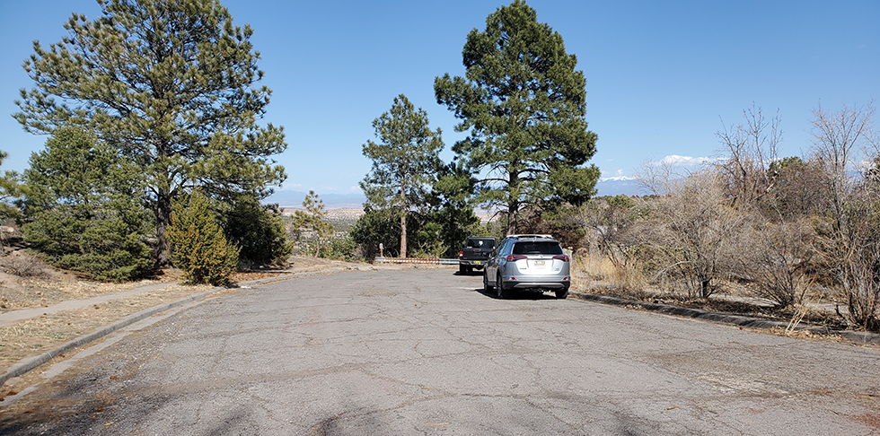
Finding the Trailhead: From the intersection of Diamond and Trinity, head toward the golf course on Diamond Drive. At the roundabout intersection with San Ildefonso Drive, travel three-quarters of the way around the roundabout and head uphill toward Barranca Mesa (effectively making a left-hand turn). In a half-mile, make a strong right turn onto Barranca Road. Travel about one mile on Barranca Road, past Barranca Elementary on the left, and continue to the stop sign at Navajo Road. Trailhead parking is just ahead in the dead-end section of Barranca Road.
The Trail: From the parking area, follow the trail sign to leave the pavement and begin on the dirt/rock path. After just a couple hundred feet on a narrow mesa top, come to the stairs worn deep into the rock. Drop down the stairs to the saddle below.
Stop for a moment in the saddle to admire the rectangular pit, the deer trap, gouged deep into the rock.
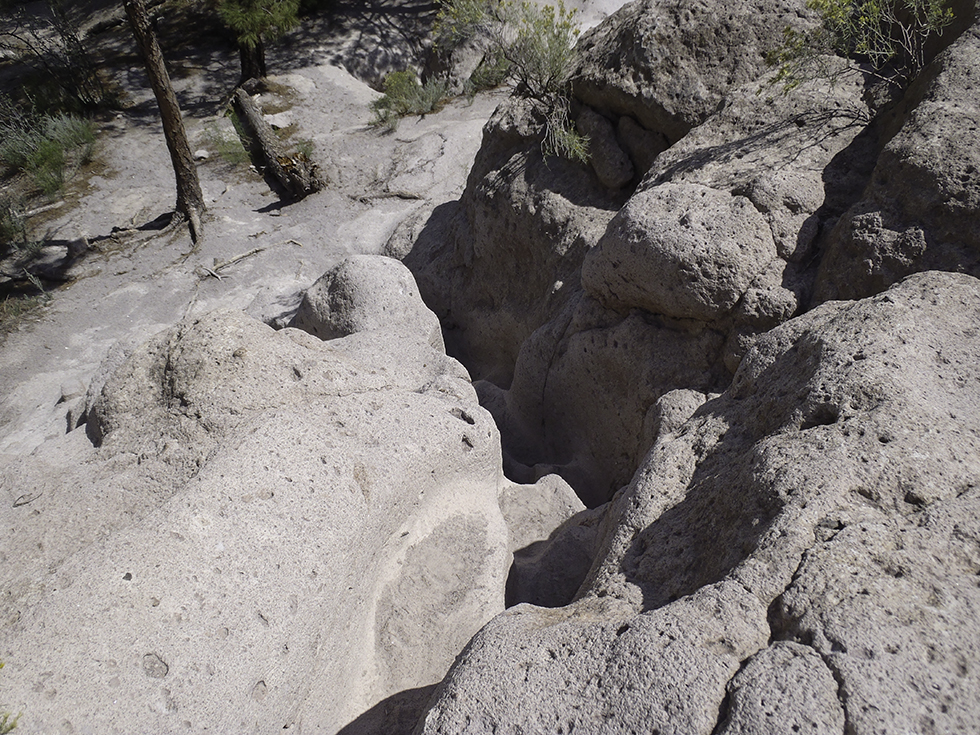
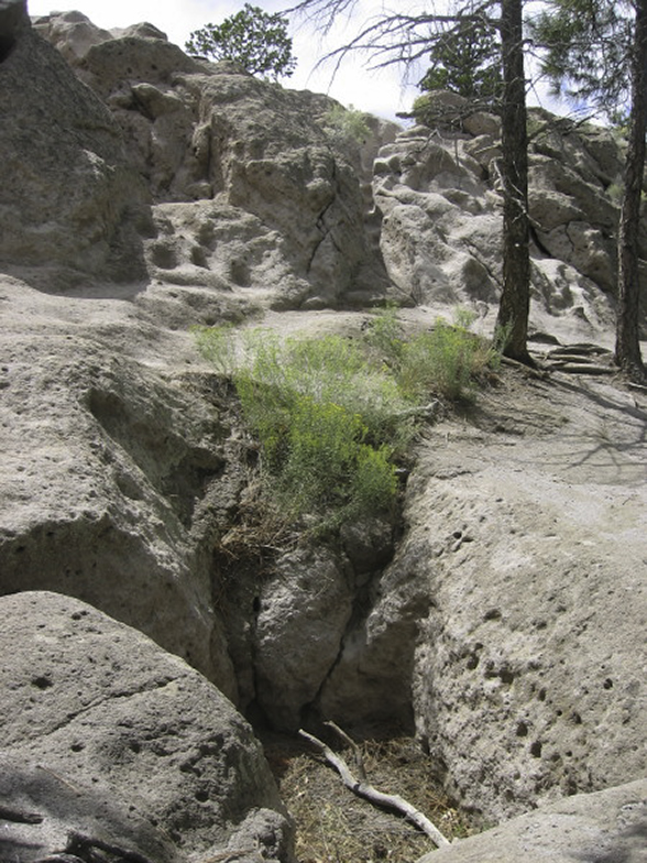
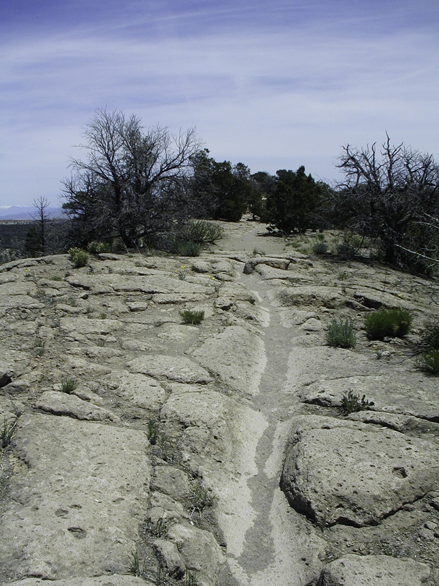
Continue on the north side of the mesa top along a narrow bench to a small stairway shallowly carved in the rock that leads through a crack in the cliff to return to the mesa top. The views now reach out in all directions.
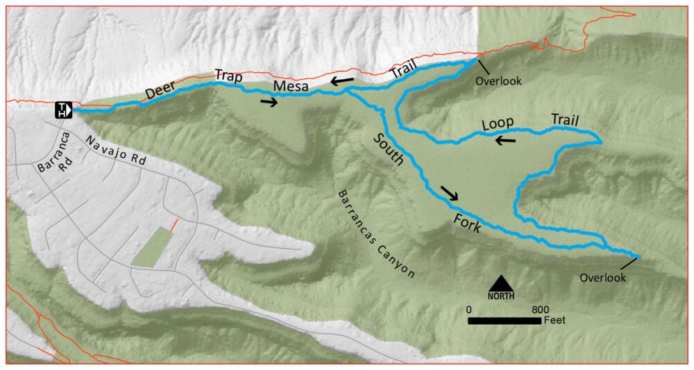
The trail winds through the short trees and a bit over a half-mile from the start, take the right fork to travel around the loop trail. The trail is easy to follow as it heads southeast quite a bit away from the canyon edge. In one mile, come to the overlook on the south fork of the mesa, looking down into Barranca’s Canyon.
After enjoying the view, retrace your steps for about 200 feet and watch for the next leg of the trail angling off to the right. Now following the canyon rim, enjoy ever-changing views over the next half mile. As the trail turns east on another finger of the mesa, watch for a sharp hairpin turn, generously marked with rock cairns, that swings the trail back to the west, following the canyon rim. Make another half-mile long, sweeping turn along the canyon rim to arrive at the overlook on the north arm of the mesa.
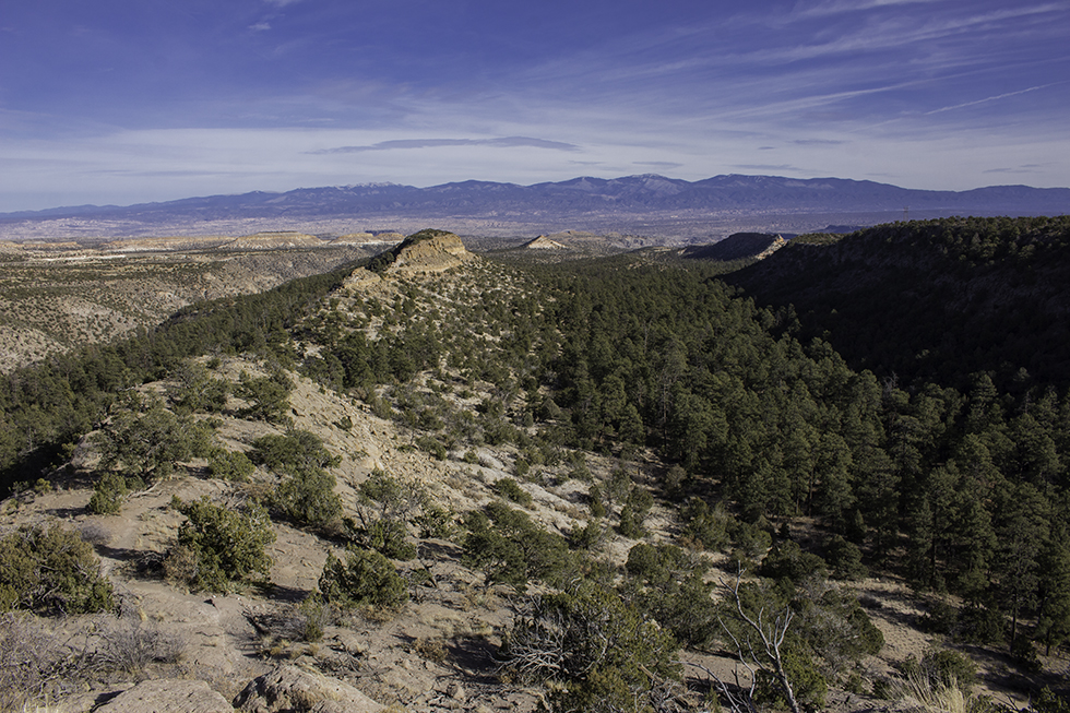
From the overlook, take the trail to the left, heading west, toward the Jemez Mountains. In a half-mile, reach the intersection with the loop trail to the left, and continue straight to retrace your steps back to the trailhead.
Variations: If you are looking for a shorter trip more suitable for families, stay left at the first major intersection about a half-mile from the trailhead and walk to the northern overlook, returning by the same route. Another option begins at the north overlook (see red line heading east on the map). Take a few steps to the east and locate a trail that heads down the slope onto the flat area below. It is steep at first but soon levels out. Continue along the ridgeline, then drop through several switchbacks to reach a saddle. From here you can follow a trail north to drop into Rendija Canyon, or route-find your way to continue along the ridgeline for more than a half-mile before reaching San Ildefonso Pueblo land where you must turn around and return by the same route.
And read the stories of the homesteaders of a by-gone era on the plaques near the beginning of the trail.