Article and Images by Fraser and Cathy Goff
In these days of quarantine, there’s no better time to explore the fabulous geology of Los Alamos. Geology is the science concerned with the solid Earth, the rocks of which it is composed, and processes by which they change over time.
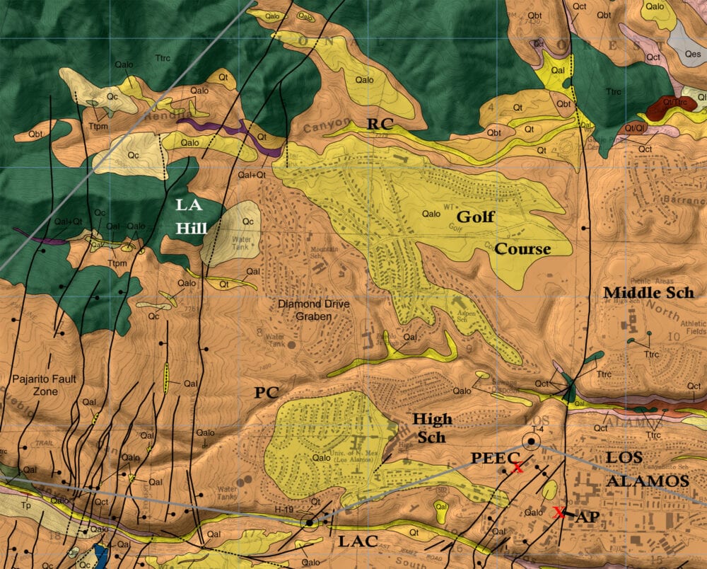
The major rock types in Los Alamos formed from volcanic eruptions. These rocks have been faulted and eroded over time to shape the rocks we see today. These rocks and faults are displayed on the following geologic map of the area (Fig. 1).
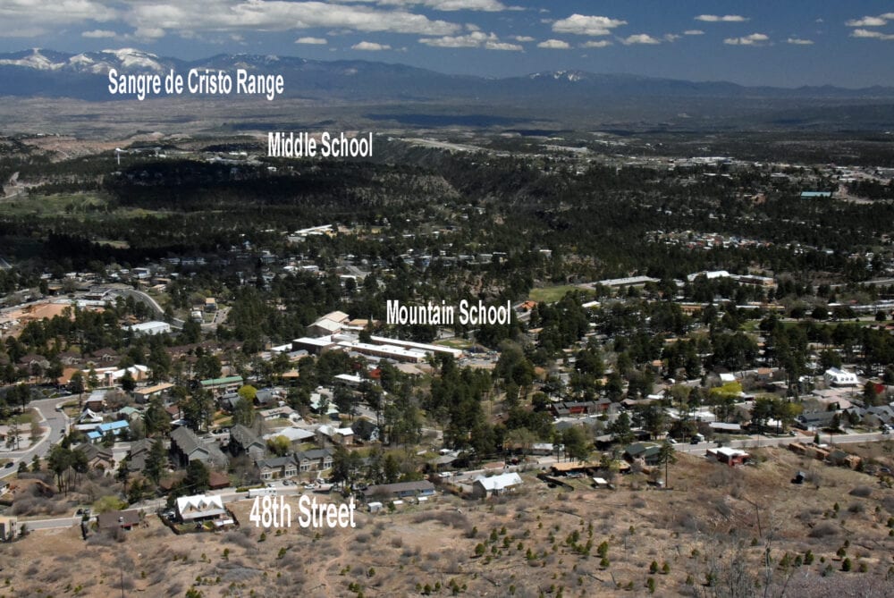
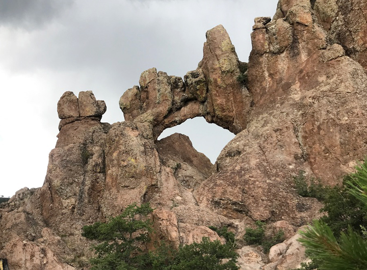
The oldest volcanic rocks are tall ridges and bluffs found on the west and north sides of town. These formed during extensive eruptions of Rendija Canyon lava flows (Fig. 2). Their sources are further west of town, though the exact source has not been determined, and they are about 5 million years old. Rendija lava flows form a rock called “rhyodacite.”
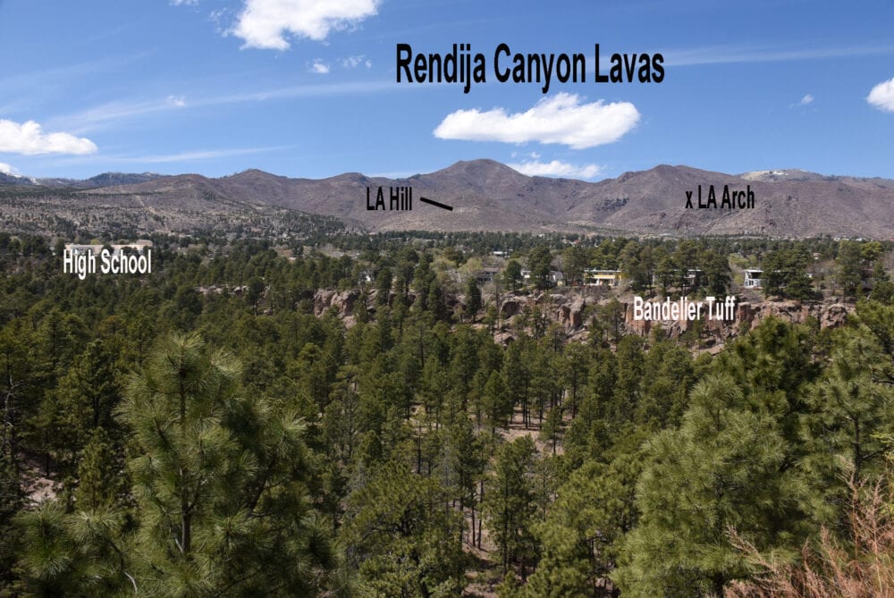
During the eruption, they were sticky, viscous liquids that flowed slowly like taffy and stacked hundreds of meters thick. The lavas contain conspicuous crystals of white feldspar, that are about 2 cm long or less, and smaller, clear quartz (Fig. 3). The best place to see Rendija flows are at the Natural Arch off Mitchell Trail (Fig. 4) or the trail to Los Alamos Hill from 48th street.
Bandelier Tuff is the younger volcanic unit found in Los Alamos and is composed of layered pyroclastic flows. Pyroclastic flows are mixtures of hot gas, ash, pumice, crystals, and pre-eruption rock fragments that move downslope at high velocity — up to about 500 km/hr (300 miles/hr). The tuff formed 1.25 million years ago during explosive eruptions of the Valles Caldera west of town.
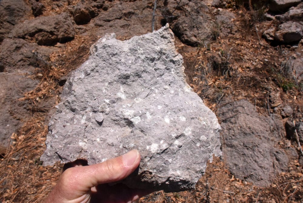
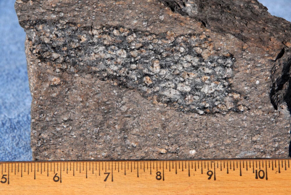
Lower flows are whitish and soft — Ancestral Pueblo people cut caves into them. You can find examples of these caves along the Main Loop Trail at Bandelier National Monument. Upper flows are orange-tan-gray (Fig. 2) and tend to form cliffs. The tuff contains many crystals, but they are small and easily missed. They are clear quartz and clear iridescent-blue feldspar (Fig. 5). The best place to see layered tuff is from along the fence outside the Los Alamos Nature Center, but many other Los Alamos trails also descend into canyons and ravines of tuff.
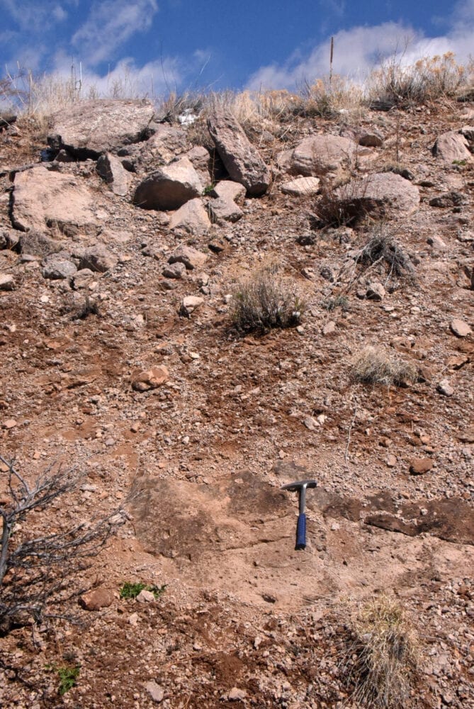
Sedimentary deposits found in the area are mostly boulders, gravels, and sands of eroded volcanics (Fig. 6). Coarse boulder layers speak to the force of ancient flash floods. The lower part of Rendija Road past the shooting range, and the outcrops across the highway from Totavi gas station are some of the best places near Los Alamos to see these boulder layers.
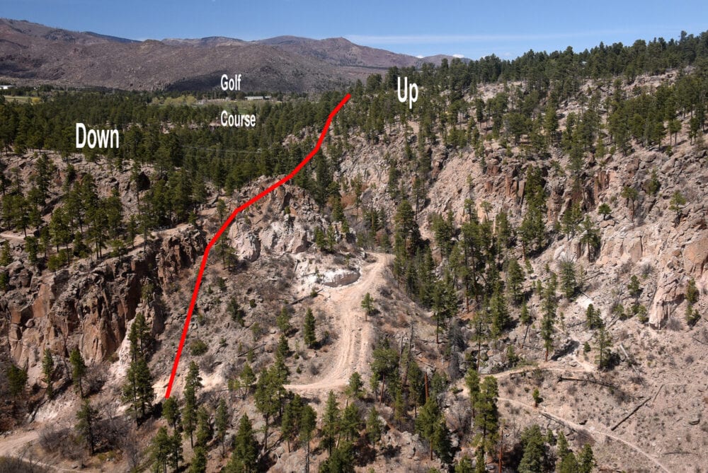
Solid black lines on the above geologic map are faults (Fig. 1). A fault is a fracture between two blocks of rock. If dashed or dotted, the fault evidence is inferred or hidden. If solid, geologists found evidence for rock rupture and displacement. Many faults in Los Alamos cut Bandelier Tuff (Fig. 7) and thus are 1.25 million years old. There is a shallow basin in western Los Alamos called the Diamond Drive graben, which is bounded on both sides by faults that dropped this basin relative to the rocks on either side (Figs. 1 and 8).
The swarm of faults west of town is part of the Pajarito Fault Zone (Fig. 1), one of the most active fault groups in New Mexico. Occasionally, small earthquakes are generated at depth along this zone and are felt by local residents.
As you hike and bike the trails, look around and ponder how this geologic landscape formed! And, don’t forget your social distancing!