Length: 2 miles roundtrip, extendable to 5 miles
Elevation Gain: 200 feet
Difficulty: Easy
Suitable For: Family hikes, hiking, mountain biking, snowshoeing and cross-country skiing on occasion
By Craig Martin
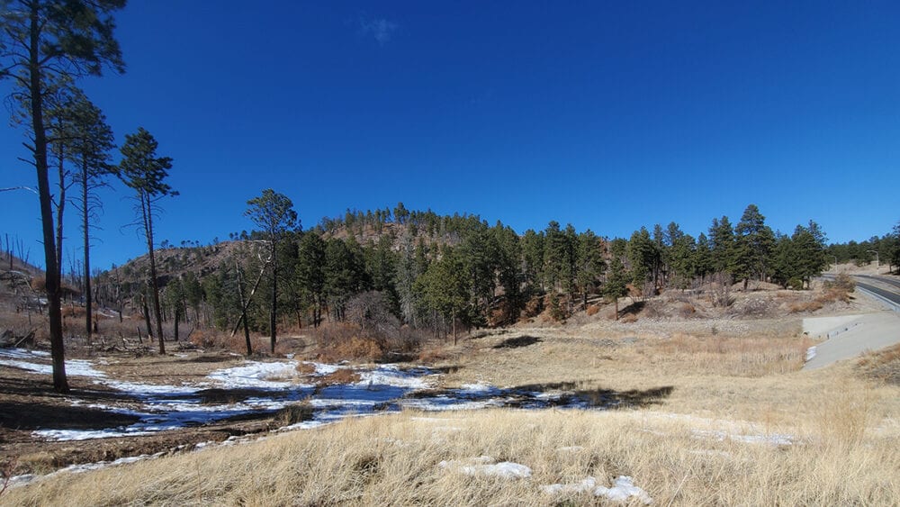
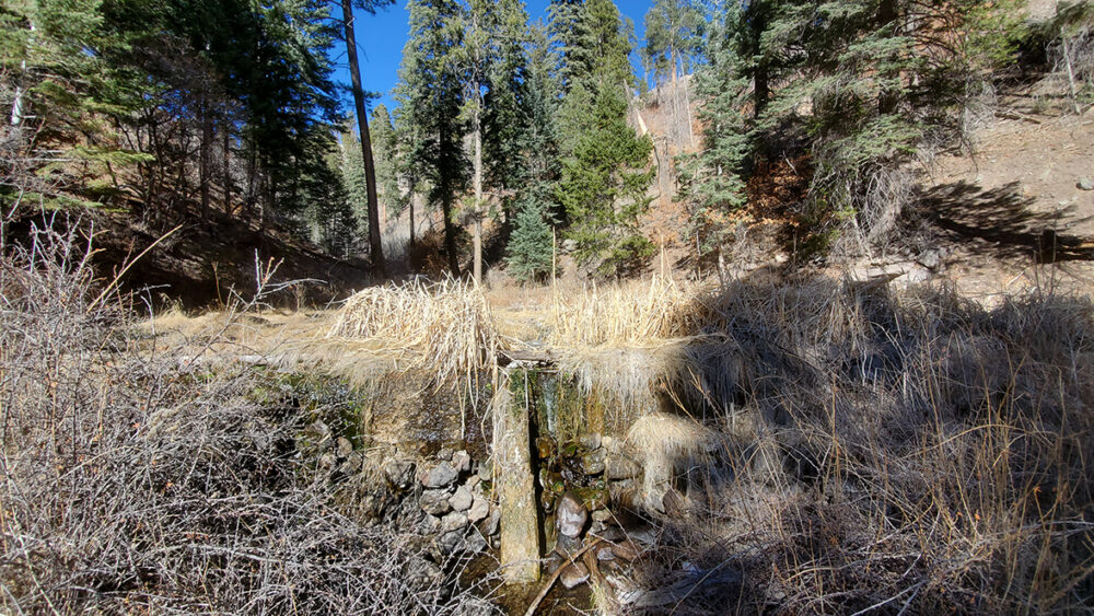
The Upper Water Canyon Trail in the Santa Fe National Forest makes a great hike any time of year. The trail is easy to follow, has little elevation gain, and offers some local history, wildlife viewing, flowing water, summer and fall wildflowers, and mid-summer raspberry picking — if you can get to them before the bears gobble them all up. The trail passes through a forest recovering from the Cerro Grande and Las Conchas wildfires, enters two old-growth mixed conifer stands, and leads to an old dam constructed by the Atomic Energy Commission to supply water to the then Los Alamos Scientific Laboratory. The two-mile roundtrip to the dam and back is easy walking for anyone.
Finding the Trailhead: The Water Canyon trailhead is located on Highway 501 near its intersection with Highway 4. If you’re coming from Los Alamos, at the intersection of Diamond and Trinity take Diamond Drive toward Omega Bridge and in a few hundred feet turn right onto West Road. Go past the ice rink and continue uphill, merging onto Highway 501 in about a mile. Continue south on 501 for 2.5 miles and park in the wide gravel area downhill from the intersection with Highway 4.
The Trail: Begin by heading downhill, with tall cattails in the drainage to the right. Swing to the left through a small meadow.
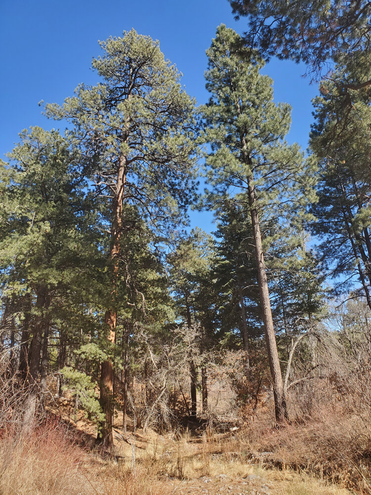
In a minute, cross the stream, pass through a stand of old ponderosa pines, and continue up the canyon, passing the intersection with the Perimeter Trail on the right.
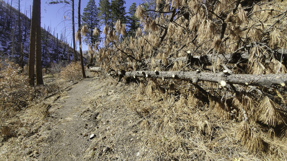
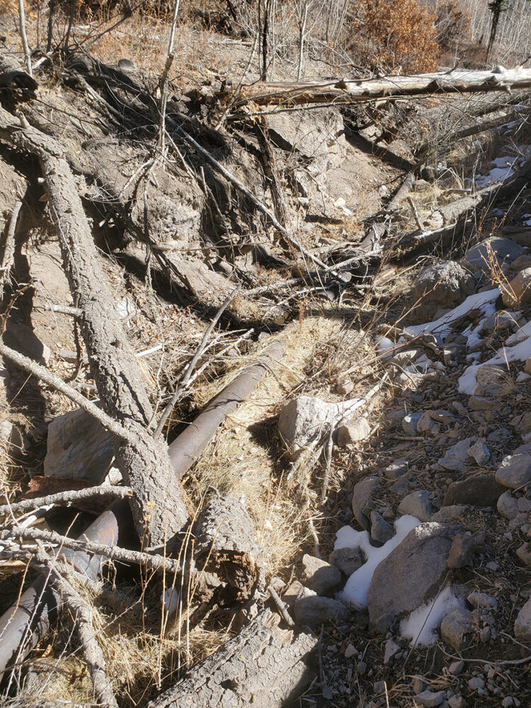
Water Canyon has been through a lot of changes in the past 20 years. As the trail heads up the canyon, note to the left the erosion channel created to control flooding that followed the wildfires. Pass along a massive ponderosa pine taken down in March 2019 by the bomb cyclone winds.

Several dozen trees were blown down across the trail during the windstorm in March 2019. The trail was cleared by volunteers. Great Horned Owls perch in the conifer stands. Watch for them, particularly in the evening.
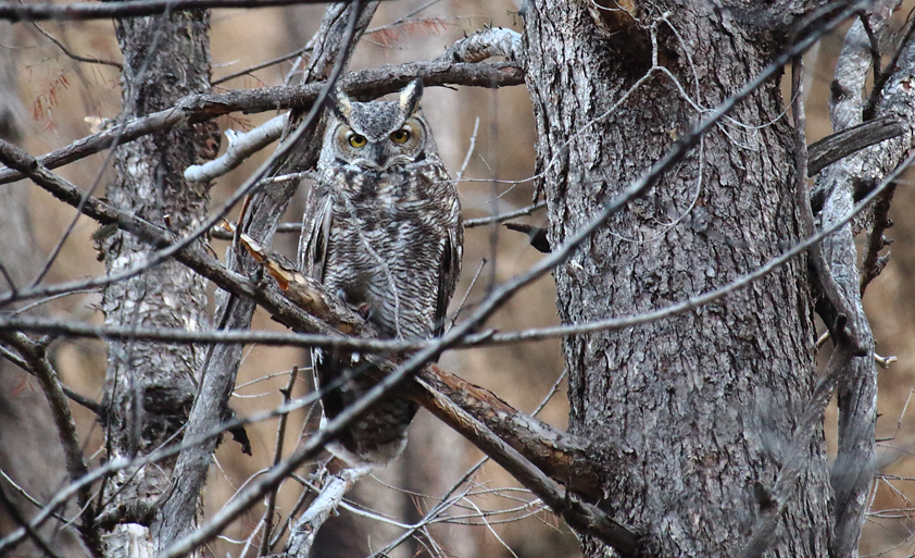
Soon pass through thickets of raspberries where in early morning and evening in July, you might see bears foraging the berries. Since the Las Conchas fire in 2011, Gambel’s oaks, chokecherries, Rocky Mountain maples, and New Mexico locust have sprouted in the burned area. After passing through a quarter mile of recovering forest, enter a shady stand of Douglas fir and white fir. Watch for Hairy Woodpeckers and, in the evening, Great Horned Owls in the conifers.
The trail parallels the stream to the left, then crosses it. Next, pass through a boulder field of rocks brought in during flooding after the Las Conchas fire. At the next stream crossing, the water pipe built in 1947 to carry water to the laboratory is clearly visible.
Enter another stand of conifers, then cross the stream coming in from the old reservoir site. When you enter a meadow, take the right fork to reach the dam. At the dam site, there is always a trickle of water flowing through the now filled-in small reservoir that supports a health cluster of cattails. After enjoying the area, return to the trailhead by the same route.
Extensions: At the trail junction in the meadow below the dam site, you can continue up the canyon on the Water Canyon Trail to reach Forest Road 181 in about a mile. If you turn right onto Forest Road 181, you can travel along the road for 2.5 miles, then turn right onto the Perimeter Trail to return to the Water Canyon Trailhead.
Nice feature. I am sure many will find these trail descriptions helpful