NAME OF TRAIL: Coyote Call Trail, Valles Caldera National Preserve
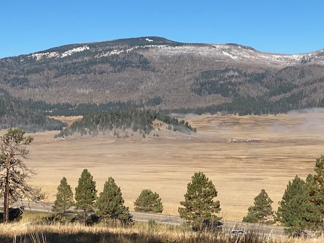
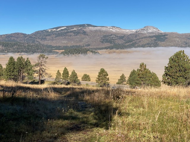
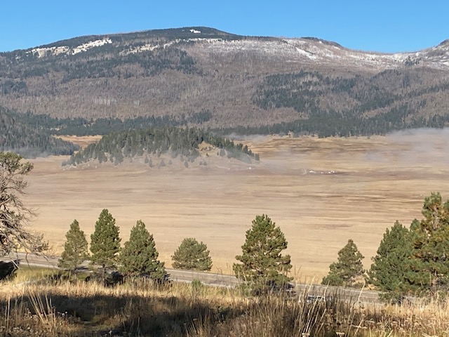
ADA ASSESSMENT STATEMENT: RATING SCALE: 1 ACCESSIBLE; 2) PARTLY ACCESSIBLE; 3 PROBABLY NOT ACCESSIBLE; 4 NOT ACCESSIBLE: (2) marginally accessible but a very nice place to perch (sit) and observe. The trail begins across State Route 4 from the Valles Caldera. It provides great views of the Caldera and the day we were there we were able to watch the fog lift out of the Valle.

OTHER ASSESSMENTS : Dogs on leash, Hiking, Nature trips, Running, Forest, Views, Wildflowers, Wildlife (All Trails, www. alltrails.com)
****
DATE OF ASSESSMENT: 10/2/2021
TIME OF ASSESSMENT: 8:30-11:30
Evaluators: Terry Foxx and Charles “Jim” Foxx
MOBILITY DEVICE USED (e.g. motorized or self-propelled wheelchair, rollator walker): Drive Medical RTL10266 Nitro Euro Style Rollator Walker, Standard Height, 10 inch wheels, 23 inches wide at the base.
OTHER EQUIPMENT: Tape Measure App (by Level Labs LLC), My Altitude App (by Dayana Networks, LTD), Steps-Activity Tracker (Pedometer and Steps, Year of Code LLC).
LOCATION: Directly across from the Valles Caldera National Perserve off State Route 4.
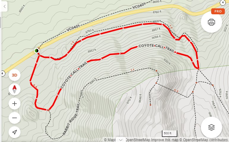
OVERALL TRAIL LENGTH: The overall length of the loop is 2.9 miles round trip.
AMOUNT OF TRAIL TRAVERSED: Less than .1 mile
ELEVATION CHANGE: 501 ft, The left hand loop was steep at 8.5 degrees. The Right hand loop was more gradual but went up steeply after about 1/8 mile.
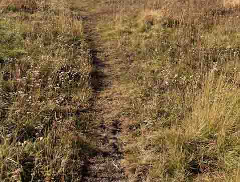
TRAIL WIDTH: 2 ft-3ft
TRAIL SURFACE: Packed soil covered by vegetation. The first part of the trail is somewhat rocky.
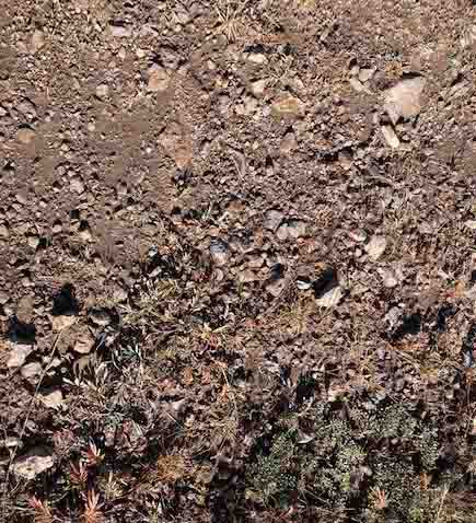
OBSTACLES/PROTRUDING OBJECTS: Most the rocks were small and not difficult to traverse
ACCESSIBLE RESTROOMS: None
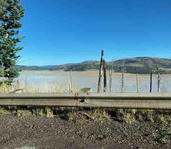
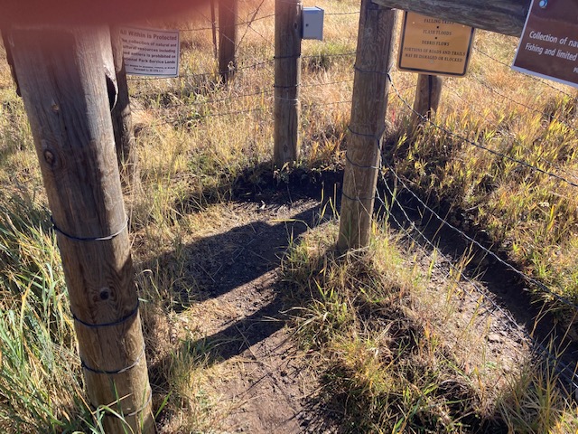
GATE WIDTH: The gate was a right angle walk through that was very challenging for the Rollator Walker.
STEPS: None
BENCHES OR OTHER RESTING PLACES: None
SHADE: none
TRAFFIC LEVEL: lightly used trail. However, it was a sunny day after several days of rain. There were 4 different hikers besides the 8 people in our party.
CONNECTING TRAILS: Rabbit Ridge Trail
ECOSYSTEM: It is a high elevation ecosystem with aspen, ponderosa pine, and other trees. There is evidence of the Las Conchas fire which consumed much of the area in 2011, 10 years ago. Many of the trees are down and surface vegetation has come back.
OVERALL ASSESSMENT OF ACCESSIBILITY: This trail is not really accessible to Rollator Walkers without a lot of effort. The slopes are steep and the rocks at the beginning make it difficult. The gate is challenging for the Rollator Walker and would not be accessible to a wheelchair.
COMMENTS: Although this area is not appropriate for a Rollator Walker to access the 2.9 miles it is a wonderful place to perch (sit) and look over the Valle Grande. The day we were there the fog filled the valley making it look like a giant lake. In approximately an hour the area went from fog to water vapor and soon you could not tell that fog had filled the valley. A good reference is by Coco Rae “Hiking Trails in Valles Caldera National Preserve.” She indicates the elevation at the beginning is 8714 ft. The trail goes to over 9600 ft. elevation.
MAPS:
The Disclaimer
The vision of the Los Alamos Nature Center is that being in nature is for everybody. Adults, children, able bodied individuals or people with disabilities. This website is presented here so an individual can make decisions for themselves as to the appropriateness of an individual trail. The items reviewed are at the suggestion of the Birdability.org.
Every individual has differing abilities and we cannot predict what challenges they may have. Because of this diversity within the human population, not all trails will work for everyone. Therefore this information is for the individual to use in their research about a trail. Each trail has been walked with a user of a Rollator walker and assessed for possible Rollator use. But as the founder of Audubon Society’s Bird ability, Virginia Rose, says “You won’t know until you go!”
So get out-side and enjoy nature. Slow down, listen, smell, and observe what is around you. If you don’t think this trail is for you, find a place to perch, observe and ask yourself the following questions: What do I notice? I wonder? And it reminds me of? (John Muir Laws) You will be amazed at what nature offers you! (John Muir Laws).
REFERENCES
The following references have been used in these observations:
Harrington, Cindy, 2017, barrierfreetravels.com/2017/07/what-exactly-is-an accessible-trail
Access Consideration for Birding Locations (https//:birdability.org/access-considerations)
U.S. Forest Service, Department of Agriculture (https://fs.usda.gov/managing-land/national-forests-grasslands/accessaability/resources. Accessibility Resources.
Laws, John Muir https://johnmuirlaws.com/deep-observation/
Hoard, Dorothy, 1993, Los Alamos Outdoors, Los Alamos Historical Society
Hoard, Dorothy, 1989, A Guide to Bandelier National Monument. Los Alamos Historical Society
Rae, Coco, 2020, Hiking Trails in Valles Caldera National Preserve.