NAME OF TRAIL: The South and North Branch of the Bayo Canyon Loop
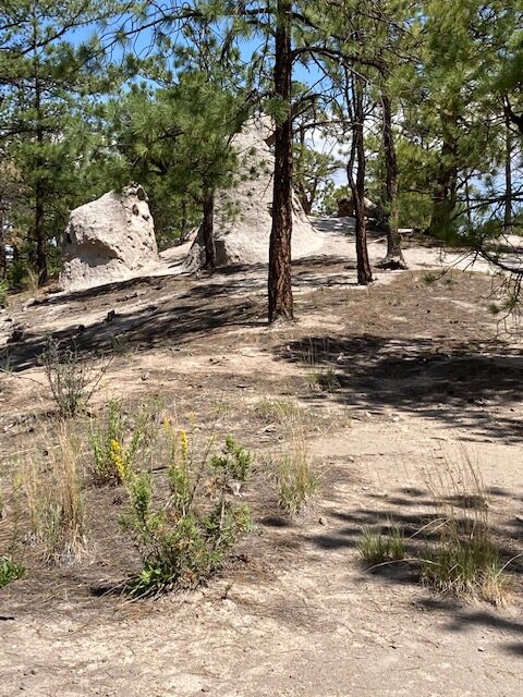
TRAIL CHARACTERISTICS AND ACCESSIBILITY: Portions of this trail is marginally accessible to the Rollator Walker IF you have the ability to walk down a 20% plus slope. Because of the slopes, this trail it is not highly recommended. Beware that there are slopes and some other obstacles that a Rollator Walker user would have to contend with. If you are willing to go downhill in a couple places the rest of the trail is very usable but remember you have to go uphill on the return. From our experience, it is highly recommended you DO NOT go beyond the tent rocks. That portion of the trail is narrow and slippery.
OTHER ASSESSMENTS : Kid Friendly, Hikers, horseback riding, mountain biking, walking, bird watching, running, dog friendly, wildlife (All Trails, www. alltrails.com)
OWNERSHIP: County of Los Alamos
****
DATE OF ASSESSMENT: 8/15/2021 South Branch; 8/29/2021 North Branch
TIME OF ASSESSMENT: 1.30 PM-3:00
WEATHER CONDITIONS: Sunny and warm
EVALUATORS: Terry Foxx and Charles “Jim” Foxx
MOBILITY DEVICE USED (e.g. motorized or self-propelled wheelchair, rollator walker): Drive Medical RTL10266 Nitro Euro Style Rollator Walker, Standard Height, 10 inch wheels, 23 inches wide at the base.
OTHER EQUIPMENT: Tape Measure App (by Level Labs LLC), My Altitude App (by Dayana Networks, LTD), Steps-Activity Tracker (Pedometer and Steps, Year of Code LLC).
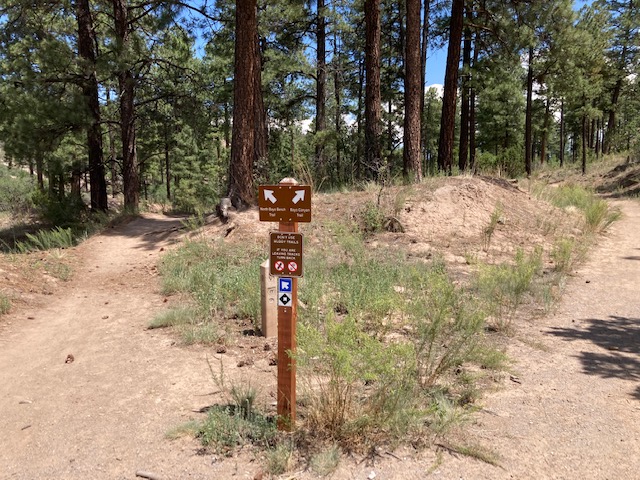
TRAIL SIGNAGE: There is no major sign at the beginning. The koisk is there and the County is revising the sign.There is a sign at the bottom of the slope that shows the two loops of the trail. We took the right loop or South Bayo Bench Trail. On 8/29/2021 we walked a portion of the Bayo Bench Trail Loop.
LOCATION:
From 15th Street and Central Avenue in downtown Los Alamos, head west (towards the Jemez Mountains) on Central. In 0.8 miles, past Ashley Pond and the Aquatic Center, turn right onto Diamond Drive. Pass the Los Alamos High School and the Los Alamos Golf Course. At the San Ildefonso roundabout located 2.4 miles from the intersection of Central and Diamond, circle halfway through the roundabout and briefly head uphill on North Mesa Road. The trailhead is about 100 feet from the roundabout on the left and there is parking for about six vehicles. (Los Alamos County Trails, Bayo Bench Loop).
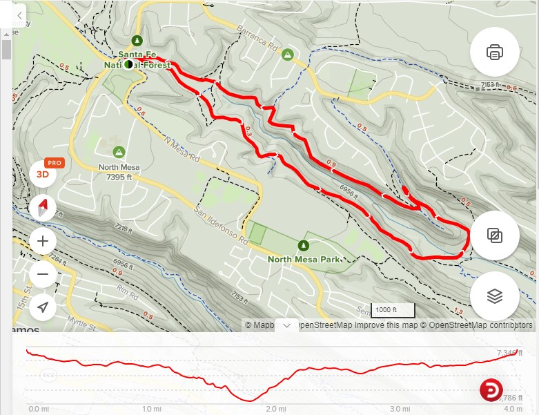
Head downhill from the parking area, but don’t go through the tunnel. Curl to the east across an open area. If you take the left fork, the North Bayo Bench Trail. This trail traverses along a bench about 50 feet below the mesa top. After about 1.5 miles, a short spur trail to the right heads to the Bayo Canyon overlook point. Visit the point or continue as the trail rounds the point of the mesa. In a few yards make a sharp right and angle down the north face of the mesa on a rutted old road. When the trail almost reaches the canyon bottom, take the left fork to avoid a sandy pitch. Cross the canyon bottom and pick up the Bayo Canyon Trail on the south side. Turn right and ascend this deeply incised trail to the south Bayo Bench. Stay on the bench for a mile back to the trailhead. (Los Alamos County Trails, Bayo Bench Loop)
OVERALL TRAIL LENGTH: The overall length of the loop is 4 miles round trip.
ELEVATION: 7312 ft at the beginning of the trail.t At the point where we stopped it was 7159 ft.
HOW MUCH OF THE TRAIL WAS EVALUATED?: One half mile was evaluated of the South Bayo Canyon Loop. Because the slope was steep, slippery and it is highly recommended to stop at the area of tent rocks. It should be noted that although much of the trail is flat, there are numerous slopes. Coming back it is uphill part of the way and takes extra effort to push the Rollator Walker. The other loop was walked on 8/29/2021 and was found to be similar to the South Bayo Bench Loop.
ELEVATION CHANGE: 600ft total. (www.alltrails.com). There are places the trail goes to the mesa or deeper into the canyon.
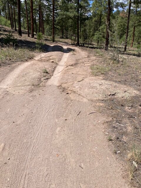
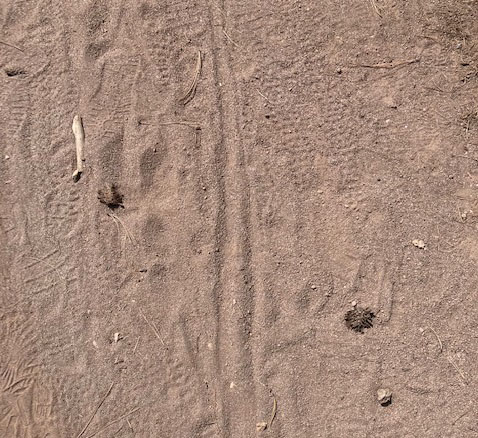
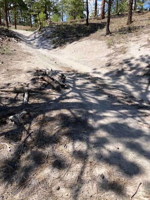
TRAIL WIDTH: 3-4 ft wide and sometimes a 2 track road where tracks are worn into the underlying rock. The Rollator Walker was able to travel the outside of the right hand track. In some places the trail has a layer of sand.
.
TRAIL SURFACE: packed soil, sand, some rocks
TRAIL SLOPE: beginning of the trail is 11.8 degrees or 20.89% ; most the trail is gradual but in two places it ranges from 24% slope to 25% slope.
OBSTACLES/PROTRUDING OBJECTS: There are a few tree roots and rocks, however most of the trail evaluated was not encumbered by obstacles.
ACCESSIBLE RESTROOMS: None
GATE WIDTH: None
STEPS: None
BENCHES OR OTHER RESTING PLACES: Few large rocks and downed trees but no benches.
SHADE: Trees shade the trail in some places.
RAILINGS: None
TRAFFIC LEVEL: A well used trail. We saw 6 bikers, 5 hikers, and 2 runners
CONNECTING TRAILS: There are lots of trails that go off from this location but it is not known where they end up. The Los Alamos County Trails description says that at 1.5 miles, on the North branch, there is a side trail that goes to the Bayo Bench Lookout.
ECOSYSTEM: A Ponderosa Pine plant community with and understory of Gambel’s Oak, Mountain Mahogany, Wild Currant. The first part of the trail is a very typical disturbed plant community with False Terragon, Gumweed, Lambsquarters, and other weedy species. Within the pine community however it was the usual Ponderosa Pine plant community.
COMMENTS: Most of the south portion of the loop is wide and mostly a comfortable walk with the Rollator Walker. However, there are steep portions beginning at the first of the trail and in two other places before the tent rocks. The slope after the tent rocks is slippery and very unstable for Rollator Walkers. The north branch is similar. There is a place where bicycles go from one side to the other side of the canyon. When walking the north branch it is important to watch for the fast moving cycles.
I highly recommend not attempting to go beyond the tent rocks under the circumstances of using a mechanical assist.
MAPS:
The Disclaimer
The vision of the Los Alamos Nature Center is that being in nature is for everybody. Adults, children, able bodied individuals or people with disabilities. This website is presented here so an individual can make decisions for themselves as to the appropriateness of an individual trail. The items reviewed are at the suggestion of the Birdability.org.
Every individual has differing abilities and we cannot predict what challenges they may have. Because of this diversity within the human population, not all trails will work for everyone. Therefore this information is for the individual to use in their research about a trail. Each trail has been walked with a user of a Rollator walker and assessed for possible Rollator use. But as the founder of Audubon Society’s Bird ability, Virginia Rose, says “You won’t know until you go!”
So get out-side and enjoy nature. Slow down, listen, smell, and observe what is around you. If you don’t think this trail is for you, find a place to perch, observe and ask yourself the following questions: What do I notice? I wonder? And it reminds me of? (John Muir Laws) You will be amazed at what nature offers you! (John Muir Laws).
REFERENCES
The following references have been used in these observations:
Harrington, Cindy, 2017, barrierfreetravels.com/2017/07/what-exactly-is-an accessible-trail
Access Consideration for Birding Locations (https//:birdability.org/access-considerations)
U.S. Forest Service, Department of Agriculture (https://fs.usda.gov/managing-land/national-forests-grasslands/accessaability/resources. Accessibility Resources.
Laws, John Muir https://johnmuirlaws.com/deep-observation/
Hoard, Dorothy, 1993, Los Alamos Outdoors, Los Alamos Historical Society
Hoard, Dorothy, 1989, A Guide to Bandelier National Monument. Los Alamos Historical Society
Rae, Coco, 2020, Hiking Trails in Valles Caldera National Preserve.