NAME OF TRAIL: Overlook Park and White Rock Canyon Overlook
LANDOWNER: Los Alamos County
TRAIL CHARACTERISTICS AND ACCESSIBILITY: I walked the whole trail from Meadow Lane, through the Overlook Park and to the White Rock Canyon Overlook. However, after the large park area, this area was marginally friendly to the Rollator Walker. The trail disintegrated from a large side walk to a pea gravel and pitted trail. Much of the area needs repaved or resurfaced to make it easily accessible.
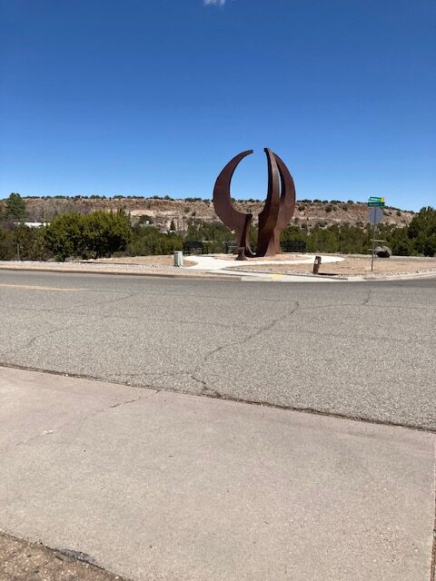
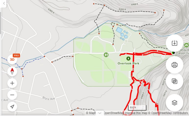
LOCATION: The trail begins off Meadow Lane across from the White Rock United Methodist Church. It follows Overlook Road. The walking trail is on the south side of the road and goes almost to the Overlook platform.
ACCESSIBLE RESTROOMS: There are two restrooms along the trail. Accessibility was not determined because of the closure of the restrooms for the winter. Accessibility is questionable because of the disintegrated nature of the trail.
OTHER ASSESSMENTS: Dogs on Leash, stroller friendly, walking, views.
***
DATE OF ASSESSMENT: April 19, 2021.
TIME OF ASSESSMENT: Mid-day.
WEATHER CONDITIONS: Sunny.
EVALUATOR: Terry Foxx.
MOBILITY DEVICE USED (e.g. motorized or self-propelled wheelchair, rollator walker): Drive Medical RTL10266 Nitro Euro Style Rollator Walker, Standard Height, 10 inch wheels, 23 inches wide at the base.
OTHER EQUIPMENT: Tape Measure App (by Level Labs LLC), My Altitude App (by Dayana Networks, LTD), Steps-Activity Tracker (Pedometer and Steps, Year of Code LLC).
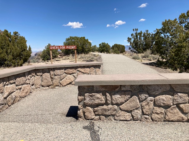
TRAIL SIGNAGE: None.
OVERALL TRAIL LENGTH: Approximately 1 mile.
ELEVATION: The beginning elevation is 6200 ft at Meadow Lane
HOW MUCH OF THE TRAIL WAS EVALUATED: The whole trail was evaluated.
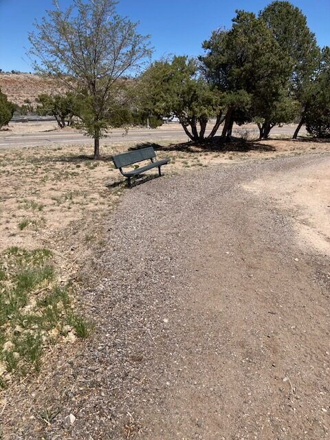
TRAIL WIDTH: The trail to Overlook Park is wide and sufficient for passing until Spirio Avenue. At that point a sidewalk or parking lot can be accessed. There are curb cutouts so walking or riding is possible. Near the end of the parking lot the trail deteriorates into a bumpy, not well maintained trail. It is only 2-3 ft wide at this point. The beginning was a sidewalk which after the large field deteriorated into a gravel and pitted trail.
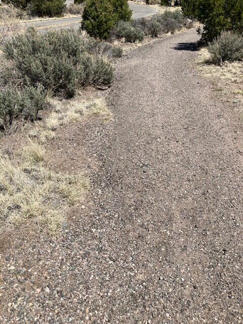
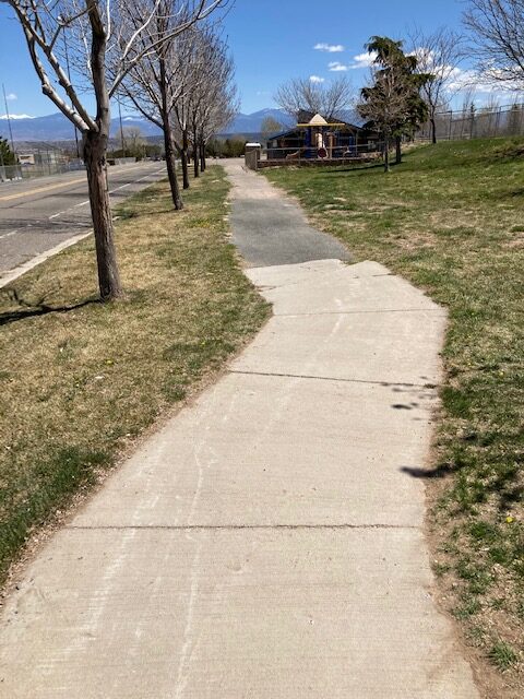
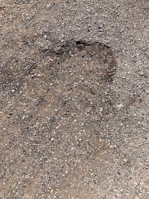
TRAIL SURFACE: At the beginning it is paved and wide. After the park area it is sometimes paved but with large divots and broken pavement or soil.

TRAIL WIDTH: 36 inches to 72 inches
TRAIL SLOPE: Relatively flat until the restrooms on the east side of the park area. From that point until the parking area for the Overlook it slopes sometimes greater than 10%
OBSTACLES/PROTRUDING OBJECTS: The pavement has been broken or non-existent after the restrooms.
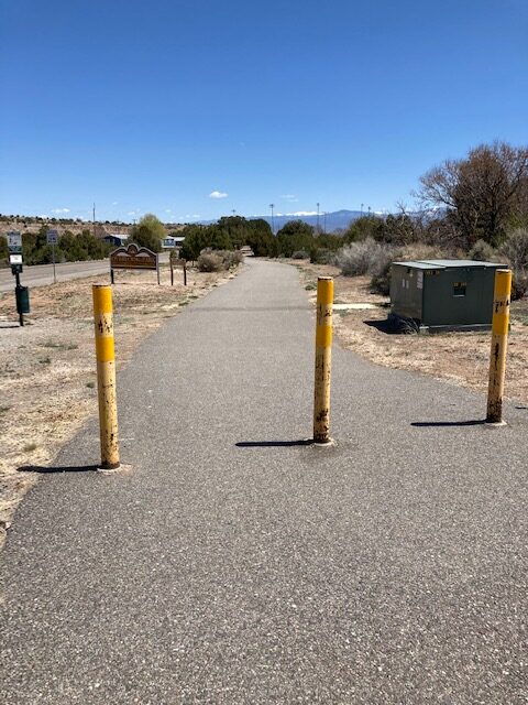
GATE WIDTH: There is a gate at the beginning of the trail to shut off Overlook Road. It was wide open and access was not restricted. There are poles on the trail to prevent automobiles and other vehicles from driving around the gate when closed.
STEPS: None
BENCHES OR OTHER RESTING PLACES: There are a number of benches along the area.
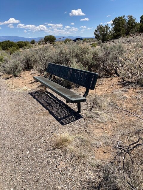
SHADE: Sunny with minimal shade.
RAILINGS: Along the Overlook Platform there are railing but not elsewhere
TRAFFIC LEVEL: At times this area is heavily used.
CONNECTING TRAILS: Behind the White Rock United Methodist Church one can access the Canada del Buey Trail. Other trails that begin along the area is the Blue Dot Trail.
ECOSYSTEM: Pinon/Juniper woodland with an understory of Big Sagerush, Skunk-bush, and Wax-Currant.
COMMENTS: According to Bob Walker (bird enthusiast this is a rich bird viewing area because of the sanitary plant.
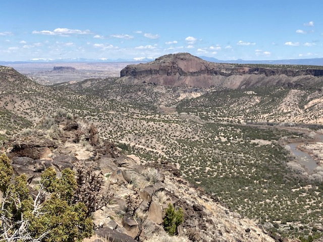
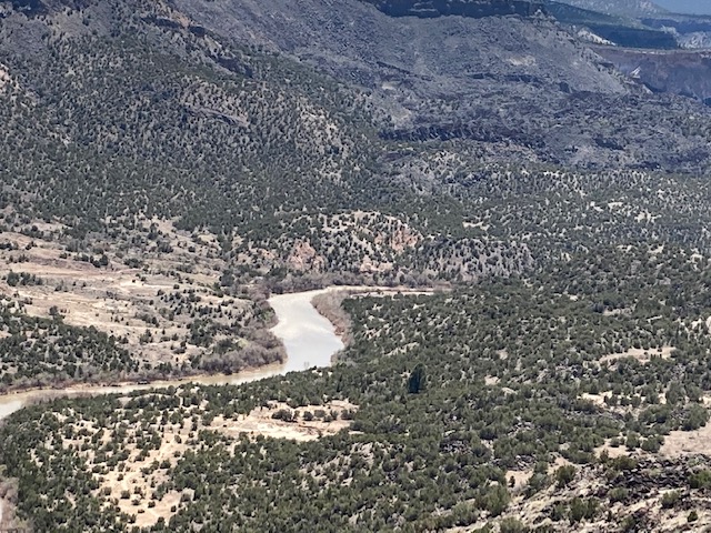
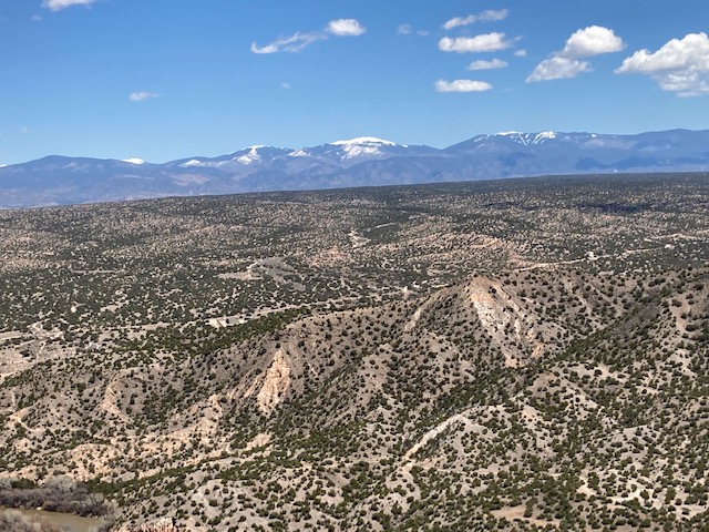
HISTORY: The views from the Overlook are spectacular of White Rock Canyon and the surrounding are. However, also one can see elements of history. Black Mesa is the home of the fearsome gian Tsaviyo, a legend held by the Tewa speaking peoples. Black Mesa figured prominately in the Spanish reconquest of New Mexico. The San Ildefonso Tribe took refuge on the mesa and defended the area for nine months against the Spanish and their allies. They finally were forced to surrender.
Looking closer you will see the area where the original road crossed the Rio Grande to give access to the Pajarito plateau. And in your view you will see Otowi Peak.
Parallelling the river one might see the reminents of of the old Chili line, completed in 1887. This little railroad carried sheep, cattle, and lumber from the Pajarito Plateau. The line was abandoned in 1941.
might spy the waterfall coming from Canada del Buey. This is the overflow from the White Rock Sewage Plant. At this point the arroyo falls steeply into the canyon and merges with White Rock Canyon, through which the river flows eighteen-hundrend miles to the Gulf of Mexico.
If you get to the Overlook early in the spring or late in the fall you will see the migrating cranes from the Bosque del Apache, their wintering ground. And throughout the winter you will observe the Golden Eagle and Bald Eagle soring on the wind in their winter range.
MAPS:
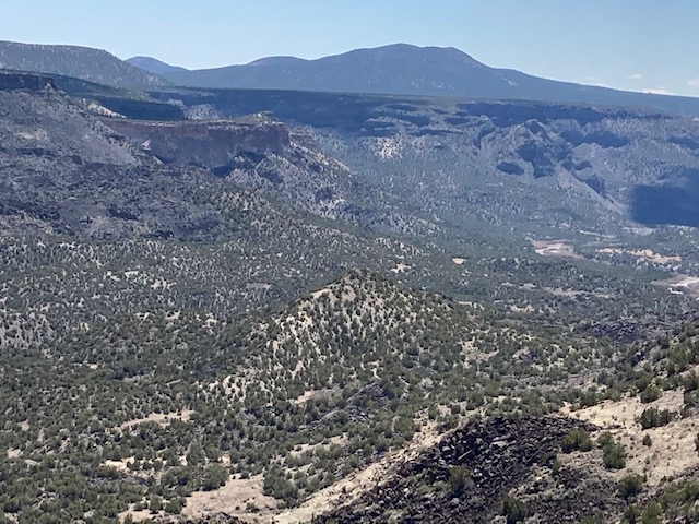
behind Santa Fe
The Disclaimer
The vision of the Los Alamos Nature Center is that being in nature is for everybody. Adults, children, able bodied individuals or people with disabilities. This website is presented here so an individual can make decisions for themselves as to the appropriateness of an individual trail. The items reviewed are at the suggestion of the Birdability.org.
Every individual has differing abilities and we cannot predict what challenges they may have. Because of this diversity within the human population, not all trails will work for everyone. Therefore this information is for the individual to use in their research about a trail. Each trail has been walked with a user of a Rollator walker and assessed for possible Rollator use. But as the founder of Audubon Society’s Bird ability, Virginia Rose, says “You won’t know until you go!”
So get out-side and enjoy nature. Slow down, listen, smell, and observe what is around you. If you don’t think this trail is for you, find a place to perch, observe and ask yourself the following questions: What do I notice? I wonder? And it reminds me of? (John Muir Laws) You will be amazed at what nature offers you! (John Muir Laws).
REFERENCES
The following references have been used in these observations:
Harrington, Cindy,2017, barrierfreetravels.com/2017/07/what-exactly-is-an accessible-trail
Access Consideration for Birding Locations (https//:birdability.org/access-considerations)
U.S. Forest Service, Department of Agriculture (https://fs.usda.gov/managing-land/national-forests-grasslands/accessaability/resources. Accessibility Resources.
Laws, John Muir https://johnmuirlaws.com/deep-observation/
Hoard, Dorothy, 1993, Los Alamos Outdoors, Los Alamos Historical Society
Hoard, Dorothy, 1989, A Guide to Bandelier National Monument. Los Alamos Historical Society
Rae, Coco, 2020, Hiking Trails in Valles Caldera National Preserve.