TRAIL NAME: Los Alamos Mesa Trail
LANDOWNER: Los Alamos County
LOCATION: You can begin this trail either from the East Park parking lot or at the end of Nambe Place off of Nambe Loop. The slope from the East Park entrance is steep, with a grade of over 20%. The Nambe Loop starting point slope is less than 10%. View the trail on Google Maps here.
PARKING: There is a large parking lot at East Park with two handicapped spots. The parking lot off of Nambe Place is smaller and does not have designated accessible spots. There is room for two or three vehicles. Despite no designated handicapped spots, it has been reported that there is plenty of space to assemble a wheelchair behind your car.
DATE OF ASSESSMENT: April 24, 2021.
TIME OF ASSESSMENT: Afternoon.
EVALUATORS: Terry Foxx and Charles (Jim) Foxx.
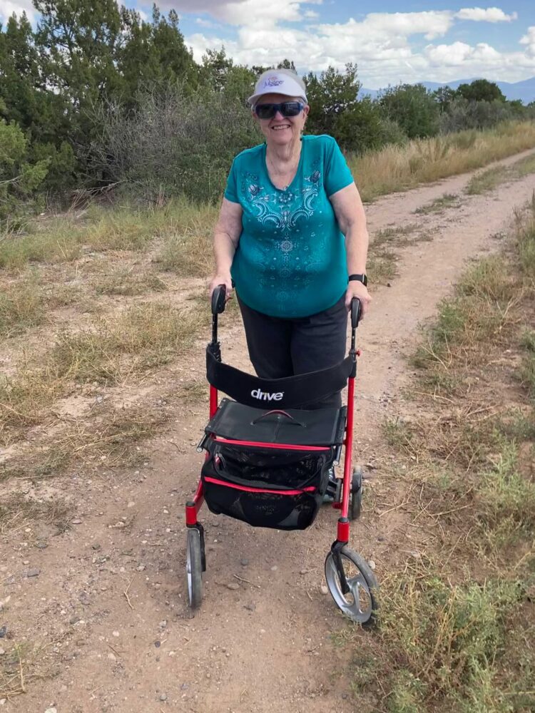
MOBILITY DEVICE USED (e.g. motorized or self-propelled wheelchair, rollator, rollator walker): Drive Medical RTL10266 Nitro Euro Style Rollator Walker, Standard Height, 10 inch wheels, 23 inches wide at the base.
OVERALL LENGTH: 1-mile round trip.
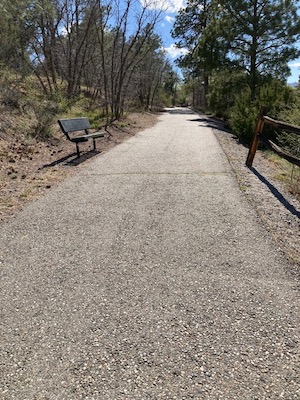
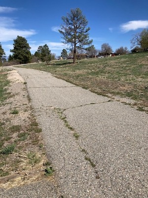
TRAIL SURFACE: Paved asphalt. The trail is wide and more-or-less flat except for the end near Aspen Ridge, which has a hill. It is fairly smooth, however big cracks have developed since it was constructed in 2007.
TRAIL SLOPE: Mostly flat, but greater than 20% at the entrance from the East Park side; less than 10% on the Nambe Place side.
RESTROOMS: Bathrooms at the East Park end of the trail were closed at the time of this evaluation. No bathrooms are at the Nambe Loop end.
RAMPS: None
STEPS: None
BENCHES: There are several metal benches around the route.
SHADE: The Nambe Loop end is open and sunny. As one goes toward the Aspen Ridge end, there are trees and shade.
RAILINGS: None
TRAFFIC LEVEL: Semi-busy, evaluators encountered dog walkers and children on the trail.
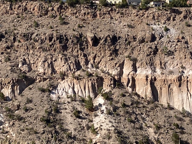
ECOSYSTEM: A ponderosa pine forest and open grassy area. Ponderosa pine, Douglas Fir, One-seed Juniper, with an under-story of oak and other shrubby species.
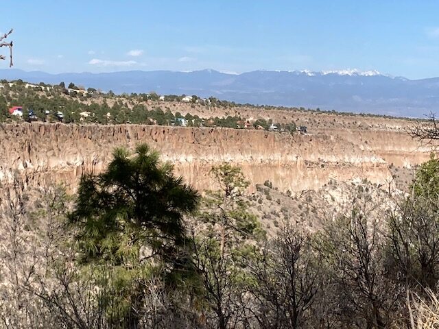
COMMENTS: This trail is about a half mile one way. I do not think I have ever walked this trail in the 50 years I have lived here before this evaluation. What a shame! It’s a beautiful, peaceful trail with benches where one can sit, view the canyon, and journal. This is a nice, wide, and paved trail. It was very accessible to a Rollator walker and I met dog walkers and children on the trail. I was so pleased and excited to find this beautiful trail.
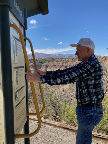
Interestingly, the trail ends or begins at Aspen Ridge Lodge Retirement Home and East Park. We started at the Nambe Loop end. I would guess they paved the trail and put up various signs and benches to complement Aspen Ridge. There are signs along the way that show different exercises and some signs that explain the canyon and flowers. The signs are called LifeTrail.
The Aspen Ridge end has a slope of greater than 20%. To me, it seemed strange to be so steep with the assisted living facility so close. Using my Rollator brakes was necessary on the Aspen Ridge end and might be difficult in a wheelchair. Dennis Beery used a wheelchair to access the trail from Nambe Place and reported that he found the trail manageable until the hill up to Aspen Ridge. However, the large cracks in the surface of the pavement were difficult for him to traverse. Hopefully, the cracks can be repaired to maintain accessibility.
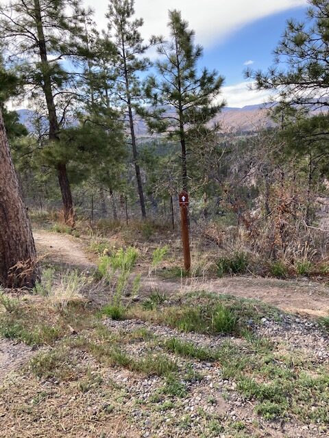
The trail ends (or begins) at the parking lot off Nambe Place and then it becomes the Pueblo Canyon Rim Trail. We only walked a short way on the Pueblo Canyon Rim. The surface is packed soil and is about 2 feet wide. I was able to navigate it a short way but did not go on because of time restraints. However, it was not too bad for me for a short distance. If more grass grows, I might have a different experience. The wheels of my Rollator got hung up a few times navigating the terrain, but I will try this trail on another day.
REFERENCES
The following references have been used in these observations:
Harrington, Cindy, 2017, “What Exactly is an Accessible Trail?”, http://barrierfreetravels.com/2017/07/what-exactly-is-an-accessible-trail/. Accessed May 9, 2022.
“Access Considerations for Birding Locations, https://www.birdability.org/access-considerations. Accessed April 14, 2022.
Forest Service, U.S. Department of Agriculture, “Accessibility Resources”, https://fs.usda.gov/managing-land/national-forests-grasslands/accessaability/resources. Accessed April 14, 2022.
Laws, John Muir, “John Muir Laws, Nature Stewardship Through Science, Education and Art”, https://johnmuirlaws.com/deep-observation/. Accessed April 14, 2022.
Hoard, Dorothy, Los Alamos Outdoors, Los Alamos Historical Society, 1993.
Hoard, Dorothy, A Guide to Bandelier National Monument, Los Alamos Historical Society, 1989.
Rae, Coco, Hiking Trails in Valles Caldera National Preserve, University of New Mexico Press, 2020.
Disclaimer
The vision of the Los Alamos Nature Center is that being in nature is for everybody: adults, children, able bodied individuals or people with disabilities. This blog is presented here so an individual can make decisions for themselves as to the appropriateness of an individual trail. The items reviewed are at the suggestion of the Birdability.org.