TRAIL NAME: Alamo Boundary Trail
LAND OWNER: Bandelier National Monument (BNM)
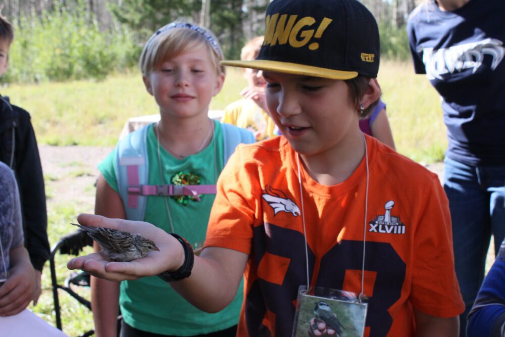
TRAIL ACCESSIBILITY: Rollator Walker was accessible to approximately 1/2 mile. The immediate area near the trail beginning might be accessible as a perching place for those with more disability. The traffic along Forest Road 289 is minimal and the area would provide a good place to sit and observe if the wind had not been so strong during our October visit. This is a common bird banding site with students. Students in wheelchairs could probably participate but not traverse the trail.
OTHER ASSESSMENTS: Camping, hiking, mountain biking, nature trips, walking, bird watching, wildlife.
****
DATE AND TIME OF ASSESSMENT: May 25, 2021 – 8AM ; October 9, 2021 – 8:30-10:30AM
WEATHER CONDITIONS: 50 degrees, strong winds during the October visit. Sunny during the May visit.
EVALUATORS: Keegan Tranquillo (BNM) and Terry Foxx May 25, 2021; Charles “Jim” Foxx and Teralene “Terry” Foxx October 9, 2021.
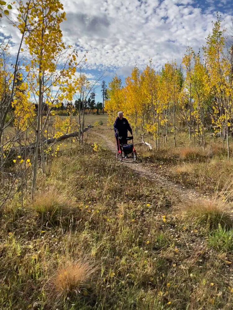
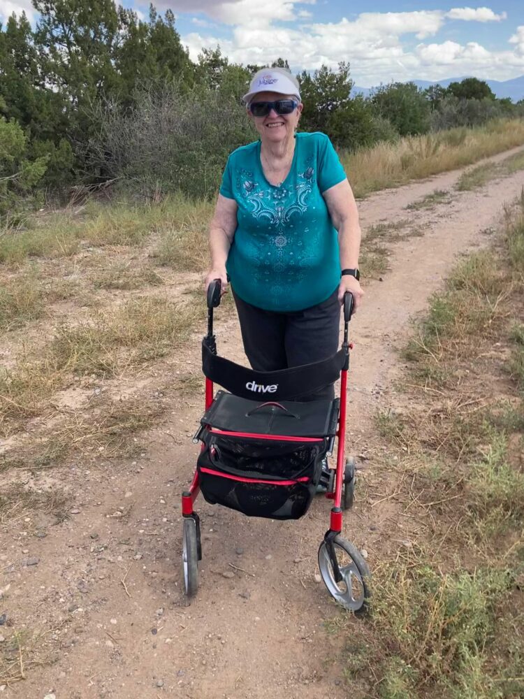
MOBILITY DEVICE USED (e.g. motorized or self-propelled wheelchair, rollator walker): Drive Medical RTL10266 Nitro Euro Style Rollator Walker, Standard Height, 10 inch wheels, 23 inches wide at the base.
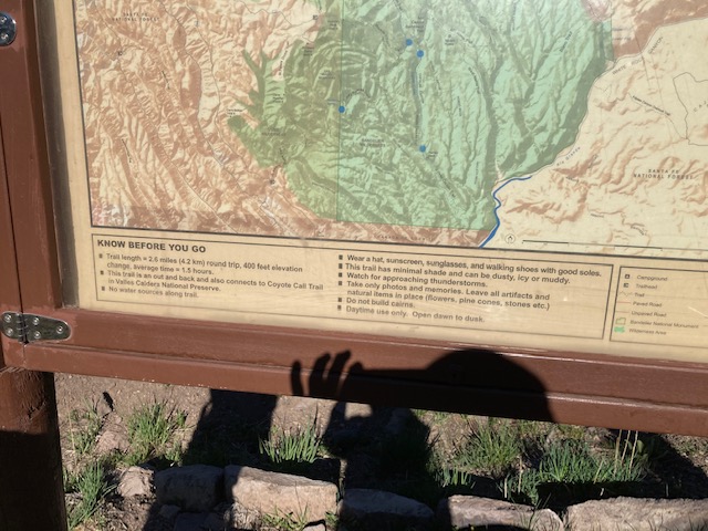
TRAIL SIGNAGE: There is a nice BNM trail sign at the beginning of the trail and parking for approximately 6 vehicles. The trail sign contains information about trail length, and trail connections.
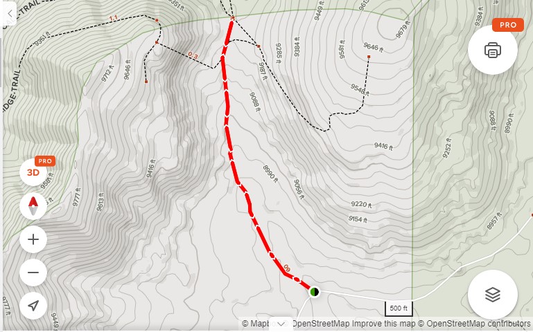
LOCATION: Off Forest Road 289. This road is on the left off State Route 4 toward the Valle Grande. There is sufficient parking for approximately 6 cars.
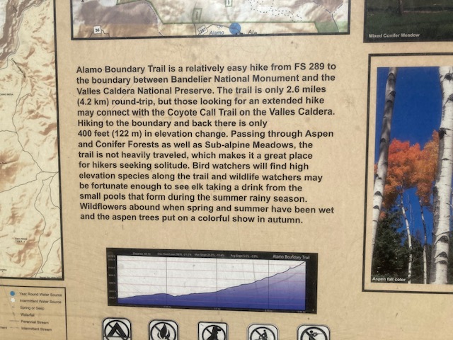
OVERALL TRAIL LENGTH: 2.6 miles round trip
ELEVATION: Slightly above 9,000 ft.
ELEVATION CHANGE: The sign says 400ft elevation change
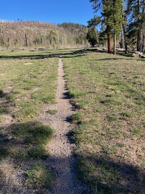
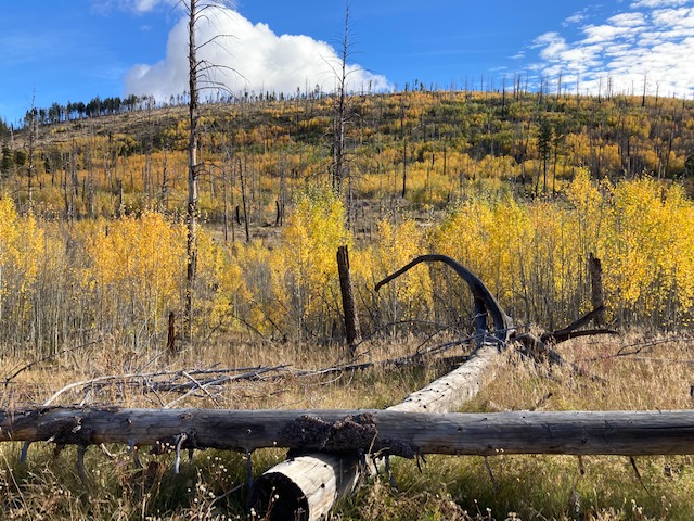
HOW MUCH OF THE TRAIL WAS EVALUATED: During the May visit we walked a little more than 1/2 mile. In October we walked to where the trees obscured the trail, approximately 2/3 mile. The area was very flat with some slopes but less than 5-10%. There was deadfall from the Las Conchas fire and so we did not attempt to go further.
TRAIL WIDTH: Approximately 2 ft wide. The grass was not fully grown in May and was dry in October. The grass provided more resistance in October.
TRAIL SURFACE: Rocky at the beginning and then packed soil with a vegetation surface. For most of the trail it was less than 2 ft wide and one wheel needed to be in the grass border. The rocks were not large, so the Rollator Walker could miss the larger rocks in the trail. At areas where the trail is narrow, placement of the Rollator wheel was important. One wheel needed to be on the packed soil and the other along the edge of the grass. This tilts the Rollator Walker and provides some insecurity. Caution must be taken not to let the Rollator Walker tip too much or a fall is possible. The Rollator Walker moved over the grass easily both seasons we visited the trail.
TRAIL SLOPE: We found most of the area we walked had a 5-10% slope and was very gradual.
OBSTACLES/PROTRUDING OBJECTS: Trail surface is rocky at the beginning. The trail is much smoother once in the aspen.
ACCESSIBLE RESTROOMS FACILITIES: none
GATE WIDTH: The gate area had deteriorated, so it was sufficient for the Rollator Walker.
STEPS: None
BENCHES OR OTHER RESTING PLACES: There were a few downed trees in the aspens that could be sat on.
SHADE: Fairly open with few trees to shade the trail.
RAILINGS: None
TRAFFIC LEVEL: When we surveyed in May there were no other hikers. However, in October there were ten hikers in our group, two hikers in another group, and the Park Service had multiple adults and children in a group to plant trees.
CONNECTING TRAILS: Coyote Call Trail
ECOSYSTEM: Old burned area with a large meadow with aspens regenerating from the fire. The meadow was grassy and the aspens were 6 or more feet tall.
COMMENTS: Other equipment I used included Tape Measure App (by Level Labs LLC), My Altitude App (by Dayana Networks, LTD), Steps-Activity Tracker (Pedometer and Steps, Year of Code LLC).
MAP:
REFERENCES
The following references have been used in these observations:
Harrington, Cindy, 2017, “What Exactly is an Accessible Trail?”, http://barrierfreetravels.com/2017/07/what-exactly-is-an-accessible-trail/. Accessed April 14, 2022.
“Access Considerations for Birding Locations, https://www.birdability.org/access-considerations. Accessed April 14, 2022.
Forest Service, U.S. Department of Agriculture, “Accessibility Resources”, https://fs.usda.gov/managing-land/national-forests-grasslands/accessaability/resources. Accessed April 14, 2022.
Laws, John Muir, “John Muir Laws, Nature Stewardship Through Science, Education and Art”, https://johnmuirlaws.com/deep-observation/. Accessed April 14, 2022.
Hoard, Dorothy, Los Alamos Outdoors, Los Alamos Historical Society, 1993.
Hoard, Dorothy, A Guide to Bandelier National Monument, Los Alamos Historical Society, 1989.
Rae, Coco, Hiking Trails in Valles Caldera National Preserve, University of New Mexico Press, 2020 .
Disclaimer
The vision of the Los Alamos Nature Center is that being in nature is for everybody: adults, children, able bodied individuals or people with disabilities. This blog is presented here so an individual can make decisions for themselves as to the appropriateness of an individual trail. The items reviewed are at the suggestion of the Birdability.org.
Oh, more of these reviews of easier trails, please! I’ve hiked a lot in the 38 yrs I’ve lived in Los Alamos, but in my 70’s now, I appreciate knowing what’s possible before going and finding out I can’t manage the trail. Thank you!