This trail has been made ADA accessible as of spring 2025.
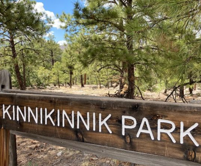
NAME OF TRAIL: Kinnikinnik Park
LANDOWNER: Los Alamos County.
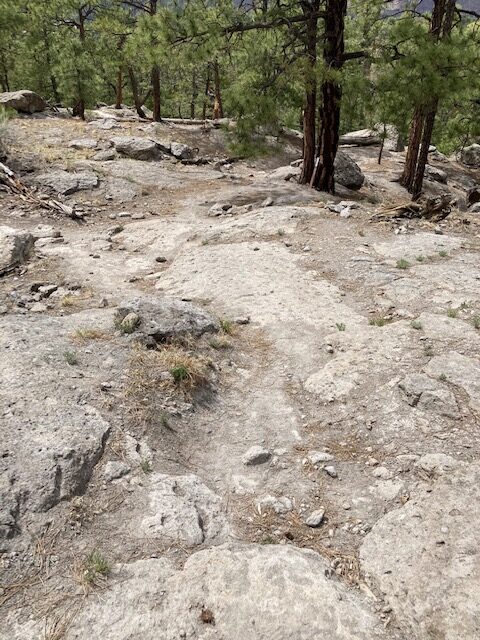
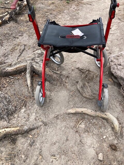
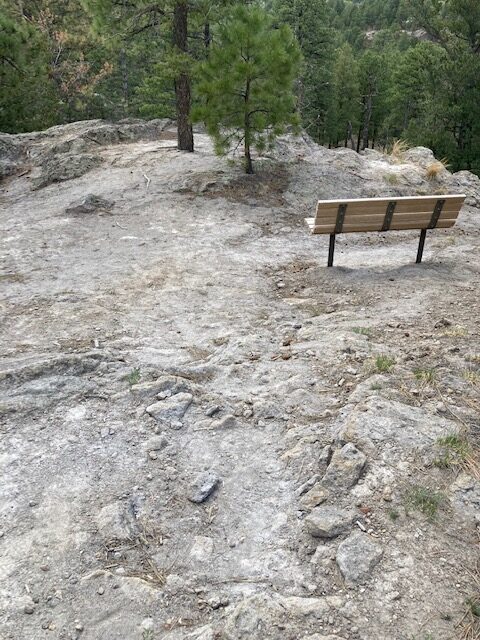
TRAIL CHARACTERISTICS AND ACCESSIBILITY: This area is not recommended for a Rollator Walker. This trail took a lot of work and determination with a mobility device such as a Rollator Walker. The Kinnikinnik Park is beautiful but very rocky with slopes of various degrees from 13 degrees (23%) to 6 degrees (10%) to less. There are large roots and rocks in the trail that are often less than 36 inches. If the County of Los Alamos paved the area and made it accessible it would enhance the Nature Center programs. Jim Foxx said, “This area is beautiful, and you feel like you are out in nature. It would enhance everyone’s experience to be able to access the area. You are close to the Nature Center and it is a wonderful spot to sit and observe.” There are bridges and benches. However, the bench was not accessible to the Rollator Walker because of rock barriers.
LOCATION: The trail can be accessed on the west side of the Larry Walkup Aquatic Center. There is also access from the Nature Center, but this route is not easily accessible.
PARKING: There is handicapped parking at the Aquatic Center and at the Nature Center.
***
DATE OF ASSESSMENT: May 13, 2021
TIME OF ASSESSMENT: Afternoon
WEATHER CONDITIONS: Sunny
EVALUATORS: Terry and Charles (Jim) Foxx: Andy and Joanne Hogan for a phenology study.
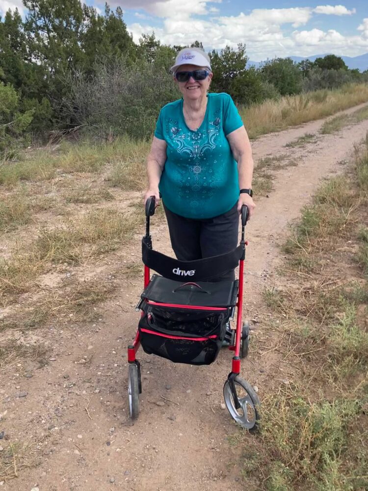
MOBILITY DEVICE USED (e.g. motorized or self-propelled wheelchair, rollator walker): Drive Medical RTL10266 Nitro Euro Style Rollator Walker, Standard Height, 10 inch wheels, 23 inches wide at the base.
OTHER EQUIPMENT: Tape Measure App (by Level Labs LLC), My Altitude App (by Dayana Networks, LTD), Steps-Activity Tracker (Pedometer and Steps, Year of Code LLC).
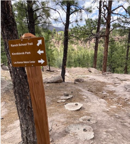
TRAIL SIGNAGE: There is a large sign at the entry to the park. There are signs directing visitors to connecting trails. There are also signs identifying plants.
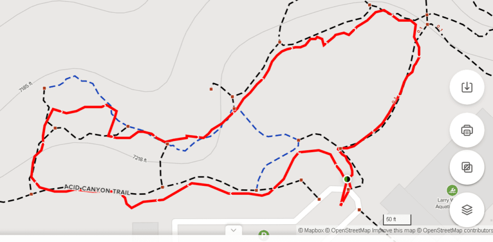
OVERALL TRAIL LENGTH: We did not walk the full length, but we walked a total of .5 miles trying different trail components in the area, which took about 1.5 hrs. We walked only on the top, not into the canyon. We mainly tried elements of the Kinnikinnik Park although there are several trails in the area and lots of confusion of which trail you are on. The trail can go into Acid Canyon, but that was not walked at this time.
ELEVATION: Approximately 7200 feet
ELEVATION CHANGE: No appreciable change in elevation (26 feet at most).
TRAIL WIDTH: The trail varied in width from 2-4 ft wide. At times there were obstacles, such as trees and rocks, that blocked a portion of the trail.
TRAIL SURFACE: Compressed dirt and rock.
TRAIL SLOPE: The slopes varied from 13 degrees (23%) to 6 degrees (10%) to less.
OBSTACLES/PROTRUDING OBJECTS: Rocks and roots provide obstacles.
ACCESSIBLE RESTROOMS: Restrooms are in the Aquatic Center or the Los Alamos Nature Center.
GATE WIDTH: None.
STEPS: None.
BENCHES OR OTHER RESTING PLACES: There are several benches, but they are not accessible due to rocks and slopes. There are accessible benches at the Nature Center.
SHADE: Multiple trees provide shade.
RAILINGS: None.
TRAFFIC LEVEL: Traffic moderate depending on time of day.
CONNECTING TRAILS: Acid Canyon and Ranch School Trails are not accessible, but there is an old road leading into Acid Canyon that may be partially accessible depending on the device and the user.
ECOSYSTEM: A ponderosa pine forest with Douglas fir, Limber pine, and other species. Understory of oak, chokecherry, and chamisa.
COMMENTS: The slope was somewhat steep for the Rollator, but I did access the trail. I made it to the Kinnikinnk Park sign and to the trail sign split (Kinnikinnik, Ranch School Trail, Nature Center). We walked what we could toward the Nature Center. It was a lot of work going around rocks, large roots and trees. In some places the trail was narrow, about 2 ft wide, and in other areas it was 4 ft. wide. At the Nature Center end it was relatively flat with some benches. I question the accessibility of the area to disabled individuals. The views would enhance a person’s experience.
MAP:
REFERENCES
The following references have been used in these observations:
Harrington, Cindy, 2017, “What Exactly is an Accessible Trail?”, http://barrierfreetravels.com/2017/07/what-exactly-is-an-accessible-trail/. Accessed May 9, 2022.
“Access Considerations for Birding Locations, https://www.birdability.org/access-considerations. Accessed April 14, 2022.
Forest Service, U.S. Department of Agriculture, “Accessibility Resources”, https://fs.usda.gov/managing-land/national-forests-grasslands/accessaability/resources. Accessed April 14, 2022.
Laws, John Muir, “John Muir Laws, Nature Stewardship Through Science, Education and Art”, https://johnmuirlaws.com/deep-observation/. Accessed April 14, 2022.
Hoard, Dorothy, Los Alamos Outdoors, Los Alamos Historical Society, 1993.
Hoard, Dorothy, A Guide to Bandelier National Monument, Los Alamos Historical Society, 1989.
Rae, Coco, Hiking Trails in Valles Caldera National Preserve, University of New Mexico Press, 2020.
Disclaimer
The vision of the Los Alamos Nature Center is that being in nature is for everybody: adults, children, able bodied individuals or people with disabilities. This blog is presented here so an individual can make decisions for themselves as to the appropriateness of an individual trail. The items reviewed are at the suggestion of the Birdability.org.
Excellent information. Definitely a trail that would be more user-friendly with some trail work on those rocks and roots.