NAME OF TRAIL: Sawyers Hill Trail
LAND OWNER: Santa Fe National Forest
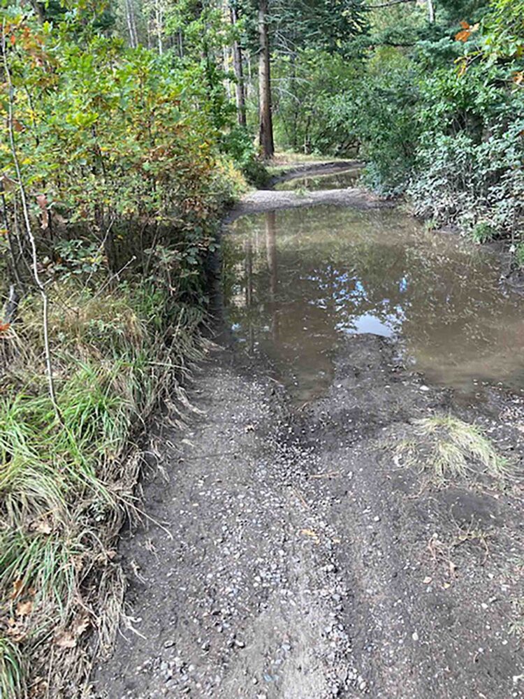
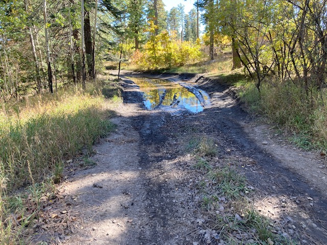
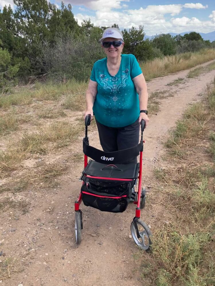
TRAIL CHARACTERISTICS AND ACCESSIBILITY: On October 3rd this area was not accessible by the Rollator Walker due to heavy rains that left very large puddles in the road. We were unable to go more than 100 ft and then we perched. By October 16th the first puddle had dried, but the other large puddle was still drying. I was able to get around the second puddle with some difficulty. Once beyond the pools of water the road is eroded and rocky. This is not an accessible area, but you could get off the main road and spend some time perched and listen to the crows, ravens, and several other birds.
LOCATION: Approximately 8 miles from the Pajarito Environmental Education Center (PEEC) Nature Center along the road to the Valles Caldera (State Route 4). The trailhead is on the right just beyond the entrance to American Springs Road.
OTHER ASSESSMENTS: Dogs on leash, Hiking, Running, Forest, Views, Wildlife
***
DATE OF ASSESSMENT: October 3, 2021 and October 16, 2021
TIME OF ASSESSMENT: 1.30-2:30 PM each day
EVALUATORS: Terry Foxx and Charles “Jim” Foxx
MOBILITY DEVICE USED (e.g. motorized or self-propelled wheelchair, rollator walker): Drive Medical RTL10266 Nitro Euro Style Rollator Walker, Standard Height, 10 inch wheels, 23 inches wide at the base.
OTHER EQUIPMENT: Tape Measure App (by Level Labs LLC), My Altitude App (by Dayana Networks, LTD), Steps-Activity Tracker (Pedometer and Steps, Year of Code LLC).
TRAIL SIGNAGE: None
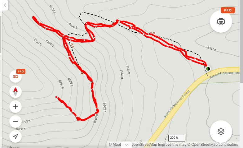
OVERALL TRAIL LENGTH: If you include the old ski area it is a 1.7 miles out and back trail. To go to the old girl scout camp it is less than of football field.
ELEVATION: At State Route 4 it is 8380 ft. The top of the old ski hill is 8859 ft.
ELEVATION CHANGE: The total elevation change was over 500 ft.
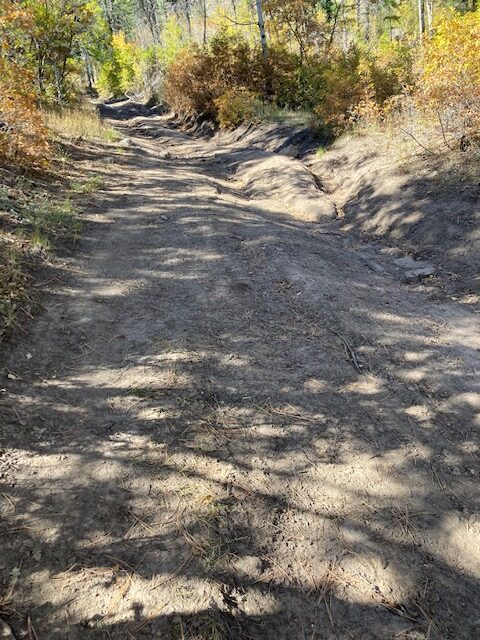
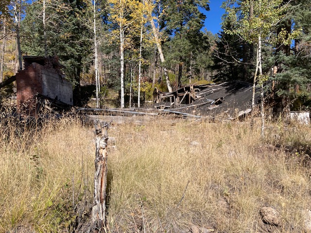
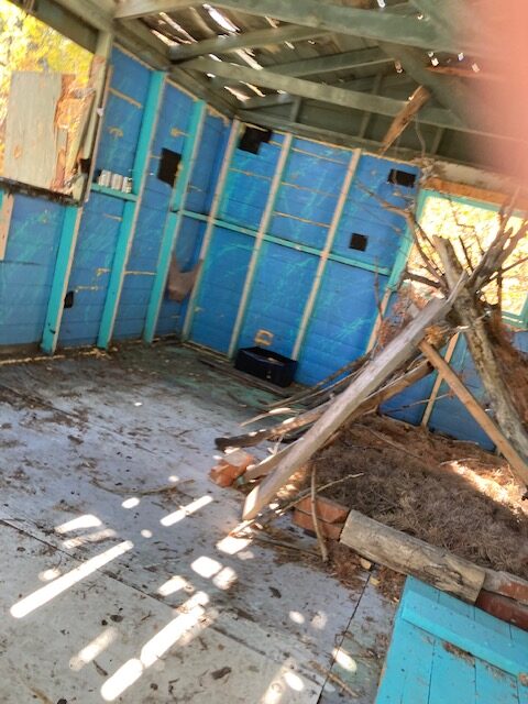
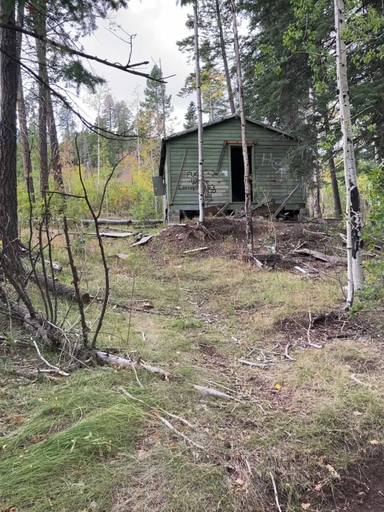
HOW MUCH OF THE TRAIL WAS EVALUATED: On October 3rd we were unable to go more than a couple hundred feet because the rain had filled the road with several large puddles. Jim walked further and got to the old girl scout camp and took pictures. On October 16th we were able to walk less than a football field one way. The road was eroded and rocky. The road going up the old ski hill was steeper and not attempted.
TRAIL SURFACE: Packed soil.
TRAIL SLOPE: Not measured.
OBSTACLES/PROTRUDING OBJECTS: The road is very eroded, rocky and inaccessible.
ACCESSIBLE RESTROOMS: None.
GATE WIDTH: None.
STEPS: None.
BENCHES OR OTHER RESTING PLACES: None.
SHADE: There are ample trees shading the road.
RAILINGS: None.
TRAFFIC LEVEL: Lightly traveled.
CONNECTING TRAILS: None.
ECOSYSTEM: A mixed conifer forest with ponderosa pine, white fir, Douglas fir, aspen, and various shrubs including Gambel oak, wild rose, and others.
COMMENTS: We remember all the controversy surrounding Sawyer Hill. The Girl Scout Counsel in Santa Fe did not want to maintain the area and when people wanted to build houses there was a great outcry. My daughter, then a girl scout, remembers fondly the times she went to day camp at Sawyer Hill.
According to Georgia McFaden, this was originally the site of the Sawyer lumber mill, a private holding within the National Forest. The Los Alamos Ranch School utilized the abandoned saw mill as a ski area. During the Manhattan Project, a power rope tow was added. The Girl Scouts acquired it, either by gift or purchase, and used it as a day camp. In the 1970s or 80s, the Girl Scout Council sold it to a small consortium of private Los Alamos citizens who started the Los Alamos zoning process to build private homes. However, this plan failed and it is now national forest.
MAP:
REFERENCES
The following references have been used in these observations:
Harrington, Cindy, 2017, “What Exactly is an Accessible Trail?”, http://barrierfreetravels.com/2017/07/what-exactly-is-an-accessible-trail/. Accessed May 9, 2022.
“Access Considerations for Birding Locations, https://www.birdability.org/access-considerations. Accessed April 14, 2022.
Forest Service, U.S. Department of Agriculture, “Accessibility Resources”, https://fs.usda.gov/managing-land/national-forests-grasslands/accessaability/resources. Accessed April 14, 2022.
Laws, John Muir, “John Muir Laws, Nature Stewardship Through Science, Education and Art”, https://johnmuirlaws.com/deep-observation/. Accessed April 14, 2022.
Hoard, Dorothy, Los Alamos Outdoors, Los Alamos Historical Society, 1993.
Hoard, Dorothy, A Guide to Bandelier National Monument, Los Alamos Historical Society, 1989.
Rae, Coco, Hiking Trails in Valles Caldera National Preserve, University of New Mexico Press, 2020.
Disclaimer
The vision of the Los Alamos Nature Center is that being in nature is for everybody: adults, children, able bodied individuals or people with disabilities. This blog is presented here so an individual can make decisions for themselves as to the appropriateness of an individual trail. The items reviewed are at the suggestion of the Birdability.org.